The Met Office has issued a rare 24-hour amber warning for wind as Storm Boelo is set to bring gusts of up to 80mph to 70 areas across the UK this weekend. The warning covers large parts of Scotland and runs from 9pm on Saturday until 9pm on Sunday.
The amber warning states: "Very strong westerly winds associated with Storm Boelo are expected with fairly widespread gusts of 60 to 70 mph and gusts to 80 mph in exposed coastal areas. The strongest winds will initially affect western Scotland and far north of Northern Ireland on Saturday evening and then spread eastwards overnight and through Sunday. High winds will be accompanied by periods of heavy rain and frequent showers. Whilst high winds are expected across a wider area with a yellow warning in force, there is a higher confidence in impacts and disruption taking place within this amber warning area. The winds will gradually ease from the west through Sunday."
Warnings and impacts
The amber alert warns "flying debris is likely and could lead to injuries or danger to life". Power cuts are also a strong possibility, with the potential to impact other services such as mobile phone coverage. Damage to buildings and trees is likely, including tiles blown from roofs and large branches or trees blown over.
Residents in the impacted areas could face travel chaos, with road, rail, air and ferry services possibly being affected. Some roads and bridges are also likely to close.
This new warning sits within wider yellow wind warnings that extend farther south into England, with this alert running from 12pm on Saturday until 9pm on Sunday. A separate yellow weather warning for wind is also in place for Northern Ireland from 10am on Saturday until 12pm the following day.
Forecasters' comments
Met Office deputy chief forecaster Mark Sidaway said: "There are a number of severe weather warnings issued for Storm Boelo, including an Amber warning for all of mainland Scotland, parts of Northern Ireland and the very far north of England. Gusts could reach up to 80mph in places. More widely gusts will still reach 50-60mph, and spells of heavy rain could also lead to some impacts. People should prepare by securing loose items outside their property, being ready in case of power outages and being aware of likely travel disruption."
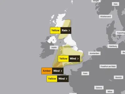
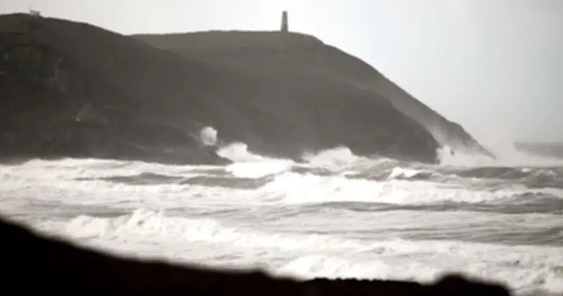
These updates came as the amber warning associated with Storm Austen expired, as the first named storm of the season moves into the Low Countries, the Met Office said. As Storm Austen hit the country, gusts of 76mph were recorded at St Mary's airport in the Isles of Scilly in the early hours of Friday morning, with 74mph recorded in Aberporth, south Wales, and 71mph at Culdrose in Cornwall.
Affected areas
Met Office Chief Forecaster Dan Suri said: "Storm Austen is moving into the Low Countries today but will still bring wet and windy conditions to large parts of the UK through the day. Yellow warnings for wind remain in place for Wales and much of England today, and a warning for rain is also in force in southern Scotland. Conditions will eventually improve briefly tonight before Storm Boelo moves in from the west."
The most severe conditions are expected in the north of the UK, but the storm will be felt across the UK. The 70 areas named in the warnings include regions in Scotland, Northern Ireland, and northern England, such as Central, Tayside & Fife, Grampian, Highlands & Eilean Siar, North East England, North West England, Orkney & Shetland, Strathclyde, SW Scotland, Lothian Borders, and Yorkshire & Humber, along with all six counties of Northern Ireland.