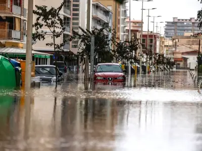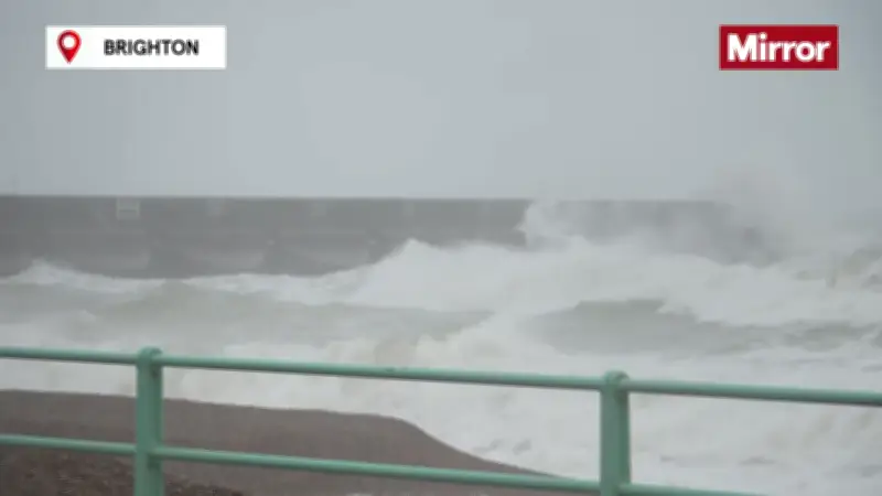
The Environment Agency has issued two flood warnings and 10 flood alerts covering areas in Devon, Dorset, Wiltshire and the Midlands as Storm Austen continues to batter the country. The flood warnings mean that flooding is expected and people should act now, moving to higher ground and moving loved ones, pets and valuables to a safe place.
Flood warnings in place for Devon and Dorset coasts
One warning covers the South Devon coast at Beesands, Torcross, Slapton and Dawlish, with seven areas particularly at risk, including exposed coastal areas at Hallsands, Beesands, Torcross, Slapton, Blackpool Sands, Teignmouth Promenade and Dawlish. A second warning covers the Dorset coast at Chiswell, with flooding expected until 11am. Six areas most at risk include A354 Chiswell, Brandy Row, Pebble Lane, Victoria Square up to the junction with Queens Road, the car parks along the A354 and the yard along Lerret Road.
The Environment Agency said the situation was being monitored closely and staff were on sites. The agency advised people to avoid seafronts and harbours due to wave overtopping and spray containing debris, and to refer to local authority websites for road closures.
Flood alerts cover rivers and coastal areas
The 10 flood alerts mean flooding is possible and people should be prepared. They cover the South Devon coast, west coast of Dorset, east coast of Dorset, River Cole in Swindon, River Stour in Black Country and South Staffordshire, River Sow and River Penk, River Soar in Leicestershire and River Churnet and River Tean. At Christchurch Harbour in Dorset, flooding is possible until around 11.15am, with the most affected locations being those on low lying land and roads near rivers or on the coast. People have been told to avoid coastal roads, footpaths and car parks, which may be flooded.
People on the South Devon coast from Start Point to Dawlish Warren have been urged to take care and avoid walking, cycling or driving through flood water. In Leicestershire, the Environment Agency has warned rising river levels at Lower River Soar may lead to flooding today, with low-lying agricultural land most at risk.
Weather warnings and wind gusts
In an update at 9.30am today, the agency said further rainfall is forecast over the next six hours, and river levels at Pillings Lock Gauge will continue rising. The agency said it is closely monitoring the situation and advised avoiding low lying footpaths and bridges near local watercourses. This message will be updated by 17:00 on Friday 23 October or as the situation changes.
A flood alert is also in place for River Cole, Dorcan Brook and South Marston Brook today, with the Environment Agency saying high river levels have already led to flooding. Further heavy rainfall is forecast over the next 24 hours, and river levels are expected to remain high throughout the day. The agency said it is checking rivers for blockages and closely monitoring the situation.
Particularly severe weather has hit parts of south-west England, where an amber wind warning covers Cornwall, Devon, the Isles of Scilly and Plymouth until 10am. Winds of 60 to 70mph are expected widely, with gusts of around 80mph possible on exposed headlands. The Met Office has warned that flying debris could cause injuries and pose a danger to life. A yellow wind warning covering south-west England, the south coast, parts of Wales and Herefordshire runs until 5pm today with gusts of 50 to 60mph likely, and 70mph or more possible in some coastal and exposed areas. Another yellow warning for wind will come into force at 10am today and run until 9pm today, covering a much wider area across England and Wales, including London, the Midlands, the North West and parts of Yorkshire, with gusts of around 45 to 55mph possible.