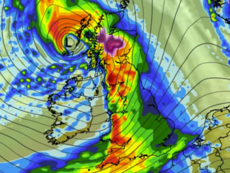
Scotland could be hit by snow this weekend as a major storm threatens to bring fierce winds, torrential rain and a spell of wintry weather to the UK. BBC Weather forecasters have warned that the first named storm of the season could arrive in the coming days, while the Met Office has issued a yellow weather warning for strong winds.
Snow Forecast for Scotland
The latest ECMWF weather model shows a large weather front sweeping across the UK on Saturday, bringing heavy rain to the south-west of England, Wales, northern England and Scotland around midday. However, conditions could be cold enough for some of the precipitation to fall as snow over higher ground in Scotland.
The forecast data suggests snowfall rates could reach around 4cm per hour in areas where the flurries are most intense. More snow could follow in Scotland during the early hours of Sunday, with the ECMWF model indicating that 16 Scottish counties could see some flurries over the weekend.
Counties at Risk
The 16 counties highlighted by the ECMWF weather model are: Ross-shire and Cromartyshire, Inverness-shire, Nairnshire, Morayshire, Banffshire, Aberdeenshire, Perthshire, Kincardineshire, Angus, Stirlingshire, Dunbarton, Argyllshire, Buteshire, Ayrshire, Wigtownshire, and Kirkcudbrightshire.
The snowfall forecast remains dependent on how the weather system develops, with higher ground potentially facing the greatest risk of wintry conditions.
Met Office Warning
The Met Office expects a weather front to move in overnight on Thursday and into Friday, with strong winds possible across parts of Wales and southern England. Wind speeds could reach 70mph in affected areas, and further warnings may be issued as forecasters gain a clearer picture of the system's track and strength.
Deputy Chief Forecaster Tom Crabtree said: "An area of the forecast we're particularly focusing on is the development of a potentially deep area of low pressure that could cross the UK overnight on Thursday and through Friday. It has the potential to bring some strong winds, though the location of the strongest winds will be determined by the low position. At this stage, people should keep an eye on the forecast and be prepared for some unsettled weather at the end of the week."
If the weather system meets the criteria for naming, it will be called Storm Austen under the storm-naming system used by the UK, Ireland and the Netherlands. However, if the area of low pressure takes a more southerly route, its impacts could be greater in France and less severe in the UK. In that scenario, France's national weather service, Météo-France, would name the system Storm Bruna.
Forecasters are continuing to monitor the developing system, with its eventual track expected to determine where the strongest winds and heaviest rainfall will hit.