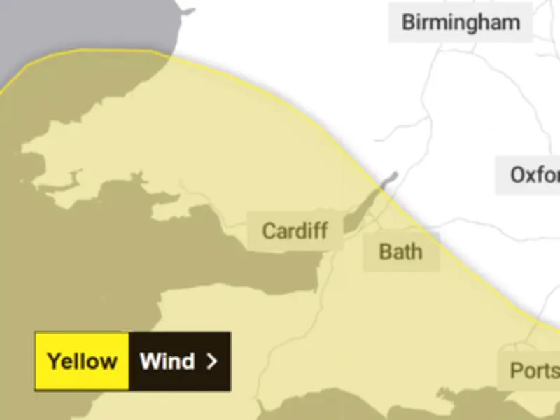
The Met Office has issued a yellow weather warning for 17 areas of Wales, with forecasters predicting gusts of up to 70mph and heavy rain as the UK could see its first named storm of the season by the end of the week.
An area of low pressure is expected to move across the UK over the coming days, bringing bands of rain and strong winds to much of the country. Mid and south Wales are set to be hit by the strongest wind gusts, with some coastal areas potentially seeing gales of 70mph, according to the Met Office.
Warning details and affected areas
The warning is in place from midnight on Friday until midday on Friday and covers the following areas of Wales: Blaenau Gwent, Bridgend, Caerphilly, Cardiff, Carmarthenshire, Ceredigion, Merthyr Tydfil, Monmouthshire, Neath Port Talbot, Newport, Pembrokeshire, Powys, Rhondda Cynon Taf, Swansea, Torfaen and Vale of Glamorgan.
The Met Office forecast says: "Strong west to northwesterly winds may spread across southern parts of England and Wales on Friday. Gusts of 50-60 mph are possible and some coastal or exposed areas could see 70 mph or more, but at this time there is uncertainty in where the strongest winds will be. There will be some periods of heavy rain which will make travel more difficult. Whilst it will remain breezy the winds will probably ease late morning into the early afternoon."
Potential impacts and safety advice
As a result of the poor weather conditions, the Met Office warns that there is a chance of some damage to buildings, such as tiles blown from roofs. There is also a small risk of injuries and danger to life from flying debris.
The gales and heavy rain could cause transport disruption, and power cuts could occur. People are asked to secure property such as bins, garden furniture and trampolines, and those on the coast are warned about the risk posed by large waves.
Potential first named storm of the season
The warning comes as forecasters say the UK could see its first named storm of the autumn by the end of the week. If the storm is named, it will be called 'Storm Austen'.
The BBC says: "Weather models suggest there is the potential for the jet stream to guide a deep area of low pressure across the UK by Friday. In addition to heavy rain, gales or even severe gales will be wrapped around the deep low."
At the moment most computer models take the centre of the low pressure system across the south of the UK. The highest risk of disruptive winds would be over southernmost parts of England and Wales and possibly some eastern coastal counties of England later on Friday. Such a track would leave Scotland and parts of Northern Ireland with quieter weather conditions. However, some computer models show the deep low taking a more northerly track, which could bring gales and disruption more widely, with impacts also in Scotland and Northern Ireland.
Due to the uncertainty of the track of the potential storm, there is potential for the forecast to change, and it is important to keep across any potential Met Office weather warnings.