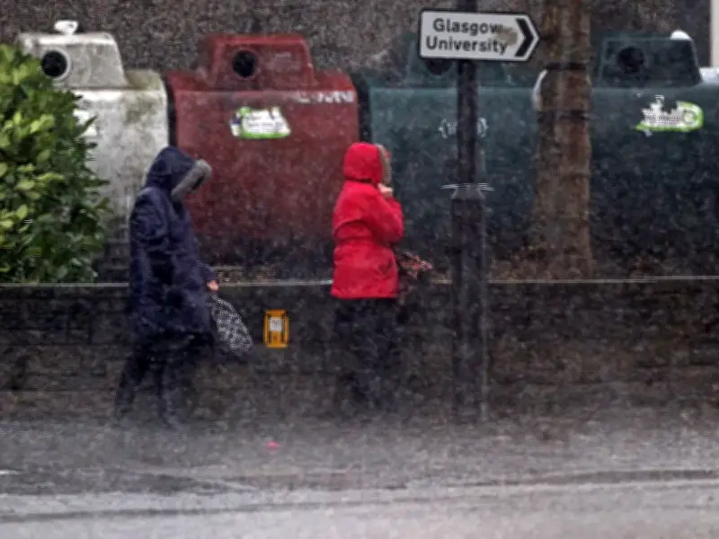
The Met Office is urging people in Scotland to prepare for potential flooding and power cuts as two storms are set to hit the country. Storm Austen and Storm Beolo are expected to bring heavy rain and strong winds over the coming days, with some areas facing difficult travel conditions.
Weather warnings in force
A yellow weather warning for rain is in force today, October 23, covering Central Scotland, Tayside and Fife, Grampian, Strathclyde, south-west Scotland, and the Lothian Borders. The warning runs from 7am until 11.59pm, with persistent downpours expected to increase the risk of flooding and cause disruption on roads and public transport.
Conditions are forecast to become increasingly unsettled over the weekend, with exposed coastal areas and higher ground potentially experiencing wind gusts of between 70 and 80mph. Meanwhile, gusts of 50 to 60mph are expected more widely.
A separate yellow weather warning for wind is due to come into force at 6pm on Saturday, October 24, remaining in place until 9pm on Sunday, October 25.
Potential impacts and advice
The Met Office has warned that the combination of heavy rain and strong winds could lead to flooding that damages homes and businesses. Travellers could also face difficult driving conditions, while train and bus services may be cancelled.
Power cuts are another potential consequence of the unsettled weather, prompting advice for households to make preparations before conditions worsen. The national forecaster is encouraging people in areas covered by the weather warnings to consider putting together a flood plan and an emergency kit, ensuring essential supplies are available if flooding or other disruptions occur over the weekend.
What to include in an emergency flood kit
The Met Office recommends gathering essential items in advance so they are available if an emergency occurs. Items to consider including in an emergency flood kit are:
- Insurance documents: Insurance paperwork and a list of useful contact numbers
- Lighting: A torch and spare batteries
- Medical supplies: A first aid kit and any prescription medication
- Warm clothing: Waterproof clothes and blankets
- Food and drink: Bottled water and snacks
- Information: A battery powered or wind up radio
- Family essentials: Supplies needed to care for babies or pets
Households are also being advised to prepare for potential power cuts before the worst of the weather arrives. The Met Office states: "It's easy to do; consider gathering torches and batteries, a mobile phone power pack and other essential items."
Areas affected by today's weather warning
The yellow weather warning for rain is in place from 7am today until 11.59pm tonight. In regards to this warning, the Met Office states: "An area of heavy rain will develop across southern Scotland before dawn Friday in association with Storm Austen, extending over northeast Scotland during the morning and early afternoon."
The forecasters add: "Accumulations of 20-40 mm are expected widely within the warning area through this period, with 60-80 mm possible in some locations, bringing flooding and travel disruption in a few places."
Regions and local authorities affected include Central, Tayside & Fife (Angus, Clackmannanshire, Dundee, Falkirk, Fife, Perth and Kinross, Stirling), Grampian (Aberdeenshire), Strathclyde (East Ayrshire, North Lanarkshire, South Ayrshire, South Lanarkshire), and SW Scotland, Lothian Borders (Dumfries and Galloway, East Lothian, Edinburgh, Midlothian Council, Scottish Borders, West Lothian).
Areas affected by the weekend weather warning
The yellow weather warning for strong winds is in place from 6pm, October 24, to 9pm, October 25. With Storm Boelo expected to bring very strong winds throughout the country.
The Met Office states: "Strong westerly winds will spread across northern parts of the UK during Saturday evening. Very windy conditions will persist overnight and through much of Sunday before gradually easing from the southwest later." Gusts of 55-65 mph are likely widely with some coastal or exposed areas potentially seeing gusts of 70-80 mph or more. Strong winds will be combined with spells of heavy rain, these most frequent over western Scotland.
Regions and local authorities affected include Central, Tayside & Fife (Angus, Clackmannanshire, Dundee, Falkirk, Fife, Perth and Kinross, Stirling), Grampian (Aberdeen, Aberdeenshire, Moray), Highlands & Eilean Siar (Na h-Eileanan Siar, Highland), Orkney & Shetland (Orkney Islands), Strathclyde (Argyll and Bute, East Ayrshire, East Dunbartonshire, East Renfrewshire, Glasgow, Inverclyde, North Ayrshire, North Lanarkshire, Renfrewshire, South Ayrshire, South Lanarkshire, West Dunbartonshire), and SW Scotland, Lothian Borders (Dumfries and Galloway, East Lothian, Edinburgh, Midlothian Council, Scottish Borders, West Lothian).