
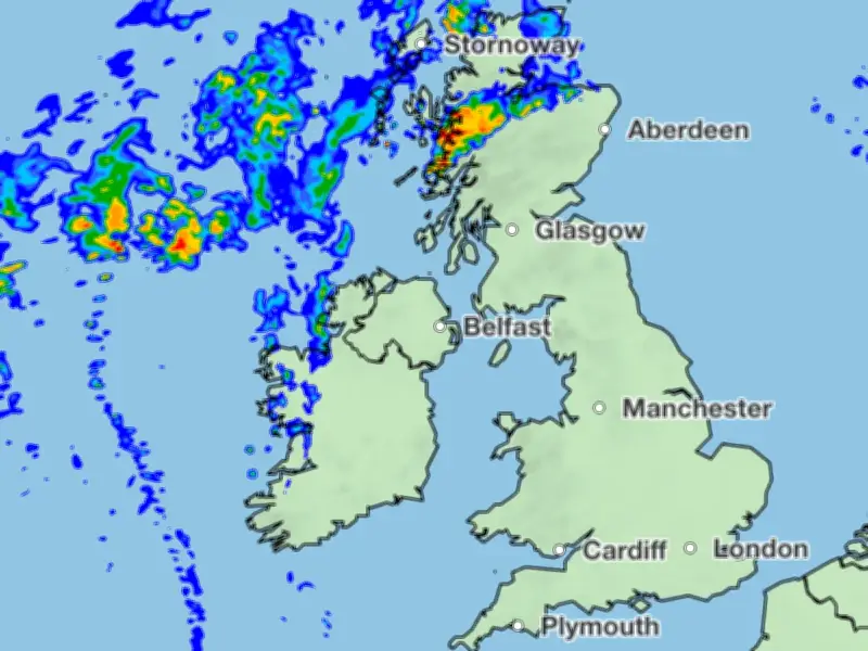
The Met Office has identified Thursday, August 13, as the day heavy rain will strike the UK following a heatwave that is set to peak at 36°C in parts of East Anglia and south-east England.
Heatwave forecast
From Monday, August 10, temperatures will climb steadily across England, starting between 27°C and 29°C, rising to 30°C on Tuesday, and reaching 32°C to 34°C on Wednesday. The peak is expected on Thursday, according to the Met Office's deputy chief forecaster, Mike Silverstone.
Silverstone explained: “After a brief dip on Monday, high pressure will move across the UK before settling to the east, allowing a southerly flow to develop. A fairly widespread heatwave is likely across large parts of England and Wales, with hot conditions developing in places. The heat is expected to peak for much of England, Wales, Northern Ireland and Scotland on Wednesday, with up to 34°C possible in parts of central and southern England and southeast Wales. East Anglia and south-east England, however, could see temperatures even higher on Thursday.”
He added: “Humidity levels are also expected to increase through the week, which may make conditions feel more uncomfortable, particularly overnight.”
North-south split
While southern areas bask in heat, a stark north-south divide will bring heavy rainfall to northern regions on Thursday morning. The worst conditions are forecast for the Scottish Highlands, where over an inch of rain could fall by 7am on Thursday, based on the forecast issued at 5am on Monday.
Until then, the country will remain largely dry, with only isolated showers in the Lake District and Scotland.
Health alerts and advice
Most of England remains under a yellow heat health alert from the UK Health Security Agency until Wednesday, with the possibility of further alerts due to high temperatures.
The Met Office advises the public to wear sunscreen, stay hydrated, avoid prolonged sun exposure during the hottest part of the day, and check on vulnerable individuals.




