
After weeks of hot weather and an uncharacteristic lack of rain across the UK, the Met Office has forecast a brief respite in the dry conditions this weekend.
It comes as the first UK area officially entered drought conditions on Thursday, July 23. North Wales and the Upper Severn became the first part of the UK to declare drought status following widespread dry weather and weeks-lasting heatwaves hit the country.
Other parts of England remain in prolonged dry weather status - the stage before drought - with hosepipe bans currently affecting around 23 million people. A nationwide hosepipe ban is in place in the Republic of Ireland in response to the dry conditions.
Rain expected over the weekend
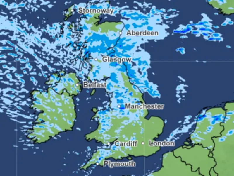
Met Office maps now show a patch of rain sweeping over the UK this weekend, marking an end to the dry spell for some places across the country.
But despite the rain in some areas, it is expected to be a 'temporary change', with dry conditions set to remain the 'dominant feature'.
Met Office Chief Meteorologist Dan Suri said: "After a prolonged spell of hot, dry and settled weather, some will see a temporary change this weekend as weather fronts move south-east across the UK."
"While some areas, particularly in the north and west, will see rain and showers, many places are likely to receive relatively little rainfall. For much of southern England, dry conditions are expected to remain the dominant feature, with temperatures recovering quickly next week and the potential for very warm or locally hot weather to return."
Timing for Greater Manchester
Met Office weather maps show a small patch of rain over Greater Manchester on Saturday afternoon from around 1pm, but this looks fairly light and will likely pass over within a few hours.
Heavier and more persistent rain is expected to hit Greater Manchester on Sunday.
From around 3am on Sunday morning, there is set to be rain across Greater Manchester and other parts of north and central England.
According to Met Office maps, this rain is set to continue, on and off, until early afternoon in Greater Manchester.
Forecast details
Met Office forecasts suggest that cloud and rain will affect parts of Scotland, Northern Ireland, northern England and north Wales for part of Saturday. More widespread rain and drizzle follows eastwards across the UK during Saturday night and Sunday morning, showers then following in the north later Sunday where they could be locally heavy.
Rainfall totals are expected to be mostly small away from western and north-western Scotland where 10-20mm of rain is likely, with locally higher totals in the most exposed locations.
Sunday is expected to be the coolest day of the weekend for many areas, with temperatures returning closer to average for the time of year and a little below average in some places.
Issuing a verdict on the end of July and August, the Met Office said that southern areas are likely to remain relatively settled and very warm, while northern parts of the UK could still see some periods of rain or showers.
"Early August could see a change to more widely unsettled conditions, but details of this are very uncertain at this stage," the forecast reads.




