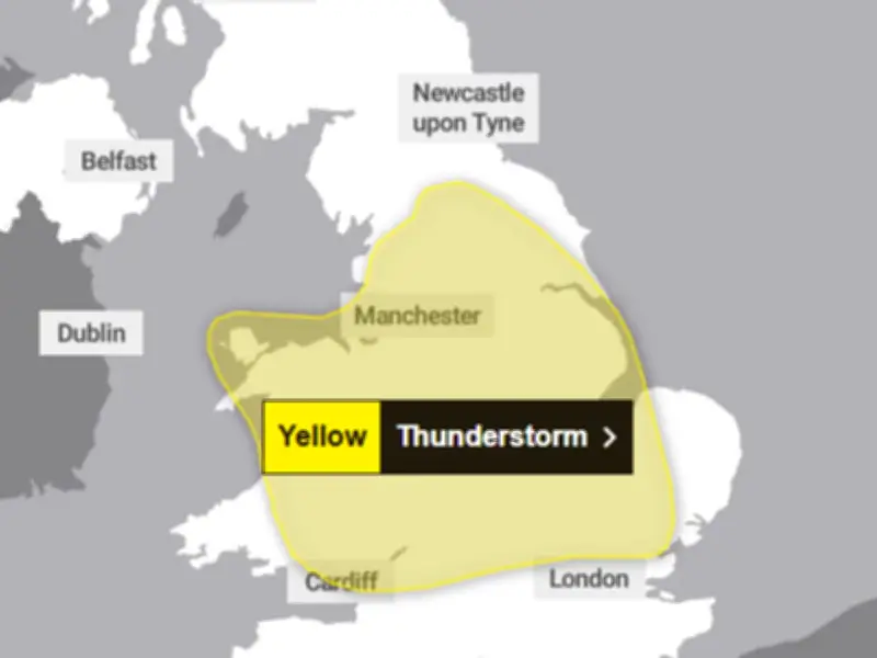
The Met Office has issued two yellow weather warnings for parts of Wales this week as thunderstorms are expected to affect areas in the country. There is a small risk of flooding and disruption due to the thunderstorms on Wednesday, August 26 and Thursday, August 27.
Warning areas and timings
The areas issued with the initial warning for Wednesday from 3am until 10pm include Conwy, Denbighshire, Flintshire, Gwynedd, Monmouthshire, Powys and Wrexham. A second thunderstorm warning in place on Thursday from 6am until 10pm covers far more of the country, including areas in south, mid and North Wales.
The second weather warning will affect Blaenau Gwent, Bridgend, Caerphilly, Cardiff, Carmarthenshire, Ceredigion, Conwy, Denbighshire, Flintshire, Gwynedd, Isle of Anglesey, Merthyr Tydfil, Monmouthshire, Neath Port Talbot, Newport, Powys, Rhondda Cynon Taf, Torfaen and Wrexham.

Rainfall and flood risk
Rainfall of up to 40-50mm is expected in a few spots on Wednesday, while more than 75mm through 12 hours on Thursday could be seen, which could lead to surface water flooding. Alongside heavy showers and thunderstorms, frequent lightning and large hail are possible.
The Met Office yellow warning for Wednesday states: "A band of heavy showers and thunderstorms is expected to move northwards on Wednesday morning. A drier, brighter interlude may follow, but with a chance of further showers and thunderstorms breaking out during the afternoon.
"Many places will miss these, but where they do occur they may be intense with 20-30 mm rain falling in less than an hour and perhaps 40-50mm in 2-3 hours in a few spots, leading to some surface water flooding. Large hail and frequent lightning are also possible. The showers and thunderstorms will drift northwards and ease during the evening."
Potential impacts
The forecaster has warned that homes and businesses could see damage from floodwater, lightning strikes or hail. Transport may also be disrupted with difficult driving conditions and train delays or cancellations expected.
There is a slight chance that power cuts could occur and other services to some homes and businesses could be lost.
The Met Office weather warning for Thursday states: "A band of thunderstorms and heavy rain will move north across England and Wales, perhaps becoming slow moving in the afternoon and evening.
"Accumulations of 20-30 mm in three hours can be expected fairly widely and up to 50 mm in a 12 hour period can be expected in places. There is a small chance that some places may see more than 50 mm in three hours and more than 75 mm through 12 hours, especially over east facing high ground. Lightning and hail of 1-2 cm will also be hazards."