
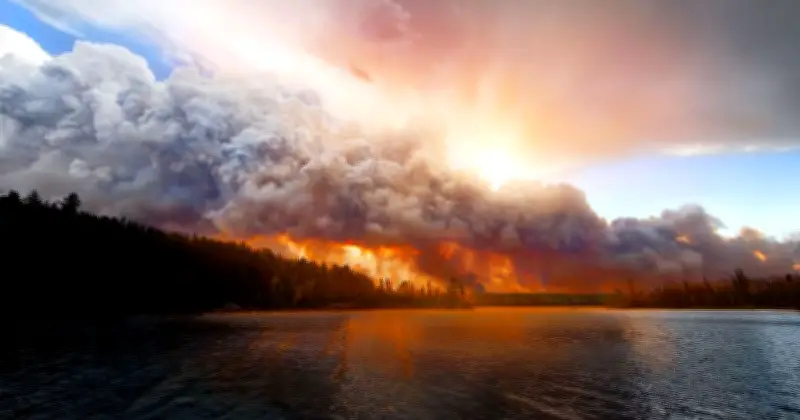
On Wednesday, July 29, 2026, the Met Office issued a warning about the increasing frequency of pyrocumulonimbus clouds, or “fire breathing dragon clouds,” during ongoing summer wildfires in Europe. These clouds can worsen fire conditions by generating dry lightning and strong downdrafts.
The Met Office explained that these clouds are “one of the more unusual features associated with large wildfires” and are generated by intense heat from fires rather than normal atmospheric processes.
How pyrocumulonimbus clouds form
As fire-heated air rises rapidly, smoke particles provide surfaces for water vapor to condense, forming clouds that can reach heights of 10–15 kilometres and extend into the stratosphere. These clouds can create additional hazards, including strong downdrafts that spread fires and dry lightning that ignites new blazes kilometres away.
The Met Office noted that NASA has described these clouds as the “fire-breathing dragon of clouds” due to their ability to worsen wildfire situations. Recent examples have been observed in France, where they contributed to worsening wildfire conditions.
UK weather outlook
In the UK, dry weather remains a key concern, particularly across England and Wales, where many stations have recorded long runs without measurable rainfall. However, Northern Ireland, Scotland and parts of northern England are expected to see repeated bands of rain, with some areas in Scotland receiving 30–40 mm.
For southern Britain, significant rainfall remains in short supply, and the Met Office said dry conditions and elevated wildfire concerns are likely to continue in the days ahead. The heat may ease somewhat after Wednesday, but the dry spell is set to last into next week.




