
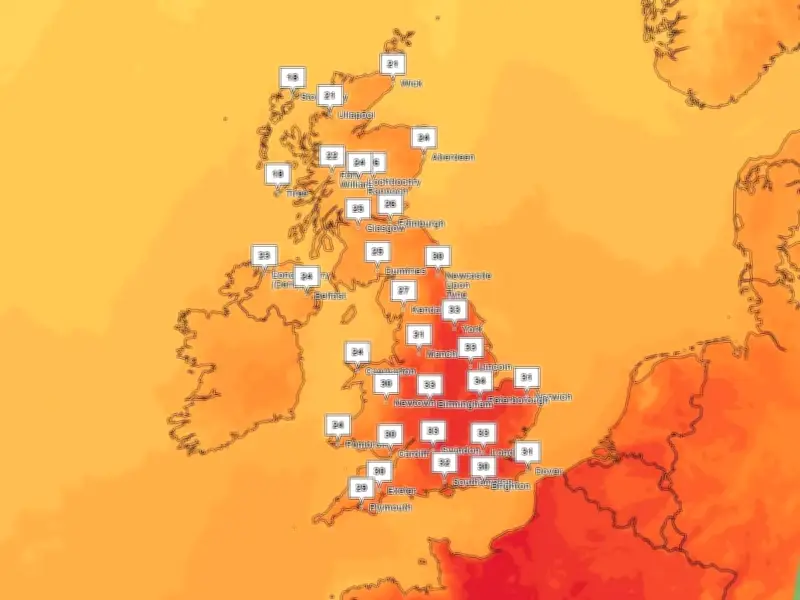
The Met Office has confirmed the exact date temperatures will start to drop this week. Regions across the UK are set for a scorching week, with temperatures exceeding 30C. Parts of the North West are under an amber heat alert, which remains in place until Friday.
Peak heat on Thursday
Temperatures will peak on Thursday (August 13), with a forecast as high as 36C in some areas. Hot weather and strong sunshine are expected throughout the week, before a fresher weekend ahead.
Met Office chief forecaster Jason Kelly said: “Heat will gradually build this week, with temperatures reaching into the mid-30s Celsius in what will be a fairly widespread heatwave for England and Wales.
“The driver for this week’s heat is high pressure, this becoming dominant over the next day or so, bringing plenty of sunshine and allowing temperatures to build day-by-day. Southerly or southeasterly winds will also tap into the hot conditions over Europe, meaning we’re looking at further notable heat for many this week, likely peaking on Thursday.”
Cooler weekend ahead
The Met Office said temperatures will ease slightly on Friday, and areas in the North West will experience a "fresh" weekend, with temperatures in the low 20s.
Sharing its verdict on when the hot weather will end, Met Office deputy chief forecaster David Oliver said: “While Thursday will be the peak of the heat this week, some warmth will remain in the south and southeast on Friday, before easing more widely on Saturday as cooler air spreads south from the northwest.”
Areas in the south of the UK may remain hot over the weekend, but it is set to cool down into the start of next week. Details are uncertain, but this may allow showers or some longer spells of rain to spread across parts of the UK.
Long-range outlook
In its long range outlook, the Met Office said we could see some rain and showery spells. The forecast for the remainder of August said: "Sunny spells and showers in the north on Saturday, with mainly dry weather in the south. Through Sunday and into the start of the following week, Atlantic frontal systems will probably approach or move across the UK, bringing some rain in places, perhaps heavy at times.
"Temperatures will likely be near normal or slightly above. Later in the period, high pressure will probably have more of an influence with drier conditions developing for many. Some rain is still possible at times, particularly in the north, together with a risk of thunderstorms in the south. Temperatures will likely be above normal."
Liverpool weather forecast: Tuesday, August 11 - 30C; Wednesday, August 12 - 32C; Thursday, August 13 - 29C; Friday, August 14 - 22C; Saturday, August 15 - 19C; Sunday, August 16 - 21C.




