The remnants of Hurricane Isaias, which has caused extensive damage and led to four deaths in the southern US, are likely to impact UK weather this week, forecasters say. The storm battered Alabama and Florida with heavy rain and strong winds in recent days.
An area of low pressure is set to bring downpours and winds to Wales early on Tuesday, with some rather grim conditions expected. However, BBC meteorologist Matt Taylor told viewers on Breakfast that they might be able to put their winter jumpers away for the next week as the remnants of Hurricane Isaias start to be felt in the UK.
Warm Spell with Muggy Conditions
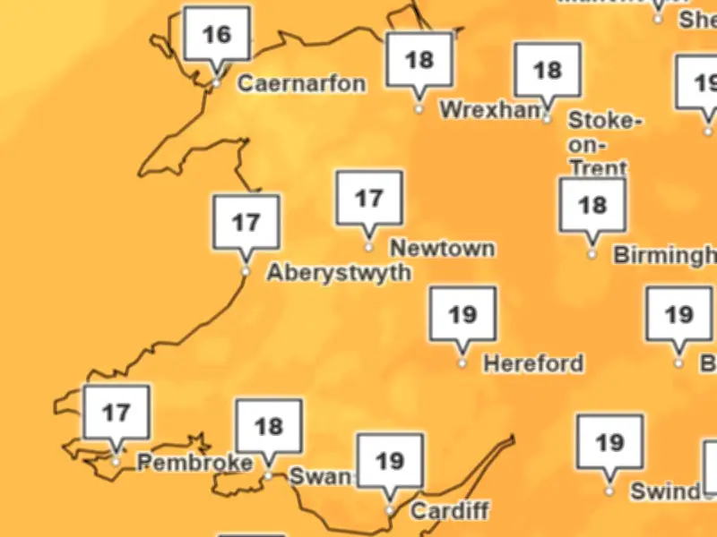
It looks set to bring a warm spell of weather, with temperatures remaining above average for the time of year. It will be mild and muggy, with highs of 20C possible. There will be scattered showers and strong winds to accompany the warmer weather.
Isaias hit the Florida coast on Saturday as a Category 2 storm, before weakening rapidly over land. As the resulting area of low pressure moves out into the Atlantic this week, it will merge with another area of low pressure coming out of Canada before sweeping towards Iceland by the end of Wednesday.
Forecasters Monitoring the System
As ex-Hurricane Isaias heads towards Iceland midweek, a plume of tropical air will arrive in the UK, the BBC say. The Met Office agrees that ex-Hurricane Isaias will have an impact on our weather, with meteorologist Alex Deakin explaining that the weather agency will be keeping "a very close eye" on the area of low pressure developing in the Atlantic.
"Crucially, it is crossing the jet stream", he said. "When these weather systems do that, they often intensify." He added: "It looks as if it's going to go between the UK and Iceland, with the strongest winds on the southern flank. It could get very windy, but it depends on the exact track of it."
Temperature Shift Ahead
He explained this weather system is being "fuelled" by a temperature contrast either side of the jet stream close to North America, with cold air to the north and warm air to the south. Some of the warm conditions on the south side are coming from where Hurricane Isaias made landfall in the US. Hence, Isaias is powering the weather system towards the UK.
Following the more unsettled weather this week, an area of high pressure looks set to move in during Friday and this could hang around into the following week. This change in pressure will bring in cooler air and is likely to make temperatures drop overnight, with highs going from around 20C down to 15C.
The Met Office forecast for the rest of the week states: "On Wednesday, bright spells and scattered showers, and strong winds with coastal gales. Winds easing through Thursday, but a band of heavy rain passes. A sunnier, more settled Friday."