
Tropical Storm Erin is rapidly intensifying, sparking concerns among meteorologists who are closely monitoring its trajectory using advanced spaghetti models. These models suggest the storm could potentially escalate into a hurricane, bringing severe weather conditions to affected regions.
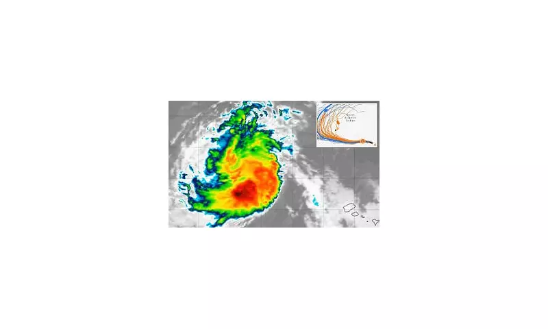
What Are Spaghetti Models?
Spaghetti models are a collection of forecast tracks from various meteorological agencies, providing a visual representation of a storm's potential path. The convergence of these models helps experts predict where the storm might strike and its likely intensity.
Current Predictions for Tropical Storm Erin
As of the latest updates, Tropical Storm Erin is showing signs of strengthening, with wind speeds increasing. The spaghetti models indicate several possible paths, some of which could lead to significant impacts on coastal areas. Residents in these regions are advised to stay alert and prepare for potential evacuations.

Potential Impacts
- Heavy Rainfall: The storm is expected to bring torrential downpours, leading to flash flooding in low-lying areas.
- Strong Winds: Gusts could reach hurricane force, causing damage to infrastructure and power outages.
- Coastal Erosion: High tides and storm surges may erode beaches and threaten waterfront properties.
How to Stay Safe
Authorities are urging residents in the storm's potential path to take precautions:
- Monitor local weather updates regularly.
- Prepare an emergency kit with essentials like water, food, and medications.
- Secure loose outdoor items that could become projectiles in high winds.
- Follow evacuation orders if issued.
With Tropical Storm Erin's path still uncertain, staying informed is crucial. Keep an eye on official updates from meteorological agencies to ensure your safety.


