
The skies over Sydney are set to unleash nature's fury as weather authorities issue urgent warnings for severe supercell storms expected to batter New South Wales. The Bureau of Meteorology has raised the alarm for potentially destructive conditions that could see communities facing multiple weather threats simultaneously.
Immediate Threats Looming
Meteorologists are forecasting a dangerous combination of weather phenomena that could create havoc across the region. Giant hailstones larger than 5cm in diameter are predicted to pummel affected areas, posing significant risks to property and vehicles. Damaging winds reaching speeds of up to 90km/h threaten to tear down trees and power lines, while intense rainfall raises serious concerns about flash flooding.
Critical Timing and Affected Regions
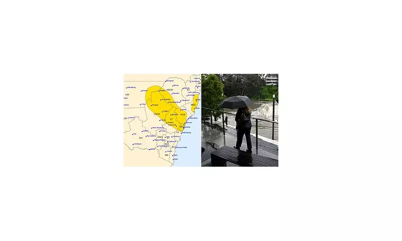
The severe weather system is expected to impact a wide swathe of NSW, with Sydney and surrounding regions facing the highest risk during Tuesday afternoon and evening. The Bureau's severe thunderstorm warning highlights particular concern for the Illawarra, South Coast, Central Tablelands, and Southern Tablelands districts, where conditions are ripe for dangerous storm development.

Emergency Services on High Alert
NSW State Emergency Service crews are standing by, ready to respond to what could be a busy period of storm-related incidents. Authorities are urging residents to take immediate precautions, including:
- Securing loose outdoor items and furniture
- Parking vehicles under cover or away from trees
- Preparing emergency kits with essential supplies
- Staying informed through official weather channels
Broader Weather Pattern Concerns
This severe storm outbreak forms part of a larger weather pattern affecting eastern Australia. While Sydney faces immediate threats, other regions including parts of Queensland are also experiencing unsettled conditions. Meteorologists attribute this activity to a combination of atmospheric instability and moisture-rich air currents creating perfect conditions for severe thunderstorm development.
The Bureau continues to monitor the situation closely, with updates expected throughout the day as the storm system evolves and moves across the state.


