
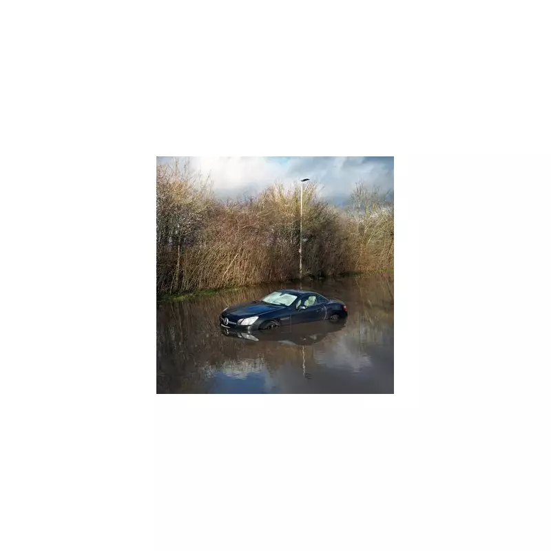
Storm Chandra is poised to unleash widespread flooding across the United Kingdom today, with dozens of areas under urgent 'danger to life' warnings. The storm system is expected to drive heavy rain northeastwards, particularly impacting regions like Dorset and Devon, leading to significant travel disruption and potential damage to homes and businesses.
Severe Weather Warnings and Flooding Risks
The Met Office has issued multiple weather warnings, including several for rain, with downpours anticipated across the Southwest and Northwest of England at various intervals. Additionally, snow is likely to fall, with the heaviest accumulations forecast for Scotland and northern England. The Environment Agency has cautioned the public about flooding hazards, noting that roads will become perilous due to standing water. The RAC has emphasised that drivers must "slow down and stay alert" throughout the day to navigate these dangerous conditions safely.
Extent of Flood Warnings and Impacted Regions
Currently, there are 67 flood warnings in place across England, along with a further two in Scotland. The majority of these warnings are concentrated around waterways in the Southwest of England, including several within the Dorset National Landscape and various locations across Devon. According to the Met Office, "Storm Chandra will bring persistent rain, heavy at times, later Monday and overnight before steadily clearing northeastwards on Tuesday morning." They predict 30-50 mm of rainfall widely, with 60-80 mm possible on higher ground, especially south Dartmoor. This rainfall, falling on already saturated ground, is likely to result in flooding and disruption, particularly on Tuesday morning.

Strong southeasterly winds are also expected, with gusts of 60-70 mph affecting eastern Northern Ireland and potential 75 mph gusts in coastal areas. The Met Office highlighted that "easterly winds of this strength are unusual and are likely to be impactful." However, flooding remains the primary concern for most regions, with the potential for landslides in prone locations.
List of Active Flood Warnings
The following areas are currently under flood warnings, indicating immediate risks:

- A361 East Lyng to Burrowbridge
- Aberbothrie, Perth and Kinross
- Bolingey Stream from Bolingey to Perranporth
- Christchurch Harbour Side
- Curry Moor and Hay Moor
- Dawlish Water at Dawlish
- Groundwater flooding for the Devils Brook
- Groundwater flooding for the Ebble Valley
- Groundwater flooding for the Hooke
- Groundwater flooding for the Iwerne
- Groundwater flooding for the North Winterborne, north of the A354
- Groundwater flooding for the Piddle Valley
- Groundwater flooding for the Pimperne Brook
- Groundwater flooding for the South Winterbourne Valley
- Groundwater flooding for the Sydling
- Groundwater flooding in the South Wiltshire Downs – The Dene
- Lower Frome from East Stoke to Wareham
- Lower Stour at Redhill and Wheatplot Home Sites
- Lower Stour from Sturminster Marshall to Christchurch
- Middle Hampshire Avon from Salisbury to Ringwood
- Middle Stour from Hammoon to Sturminster Marshall
- North Sea at Scarborough – Sandside
- North Sea coast at Bridlington – Harbour Road and Floral Pavilion
- River Avon at South Brent, Avonwick and Aveton Gifford
- River Avon from Didworthy to Aveton Gifford
- River Axe (Lower) from Axminster to Axmouth
- River Axe (Mid) at Axminster
- River Axe (Upper) from Winsham to Axminster, including Chard Junction and Weycroft
- River Bovey at Bovey Tracey and Heathfield
- River Bride at Burton Bradstock
- River Bride from Long Bredy to Burton Bradstock
- River Brit at Newtown, and Southgate Old Mill, Beaminster
- River Char at Dolphins River Caravan Park
- River Clyst from Broadclyst to Clyst St. Mary
- River Cober at Trenear
- River Coly from Colyton to Colyford
- River Culm (Lower) from Cullompton to Stoke Canon, including Hele
- River Culm (Upper) from Hemyock to Cullompton
- River Dart from Buckfastleigh to Totnes, including Staverton
- River Derwent at Buttercrambe Mill
- River Fowey at Lostwithiel
- River Fowey from Trekeivesteps to Restormel
- River Harbourne at Crowdy Mill, Beenleigh, Bow and Tuckenhay
- River Hayle from Relubbus to St Erth
- River Isla at Coupar Angus, Perth and Kinross
- River Isle at Ilminster
- River Isle from Chard Reservoir to Hambridge not including Ilminster
- River Lynher from Berriowbridge to Notter Bridge
- River Otter (Lower) at Ottery St. Mary
- River Otter (Lower) from Salston to Budleigh Salterton
- River Otter (Upper) from Upottery to Cadhay Bridge
- River Ouse at York – riverside properties
- River Parrett (lower) at Langport Westover Trading Estate
- River Parrett (upper) from South Perrott to Thorney
- River Piddle from Alton Pancras to Wareham
- River Seaton from the A38 to Seaton
- River Sid at Sidbury and Sidford
- Rivers Stour and Iwerne at Stourpaine
- River Teign (Lower) from Chudleigh to Kingsteignton
- River Tone from Bathpool to Ham including Ruishton and Creech St Michael, riverside properties
- River Wey from Upwey to Weymouth
- River Wriggle at Chetnole
- River Yarty from Yarcombe to Axminster
- River Yeo (Creedy) from Yeoford to Fordton
- The Gissage Stream at Honiton
- Umborne Brook from Wilmington to Colyton
- Upper Frome at Maiden Newton
- Upper Frome from Maiden Newton to Dorchester
- Washford River, riverside properties from Kingsbridge to Lower Roadwater
Residents in these areas are urged to stay informed through official channels and take necessary precautions to ensure their safety. The combination of heavy rainfall, strong winds, and saturated ground heightens the risk of flooding, travel delays, and potential structural damage, making vigilance paramount during Storm Chandra's passage.


