
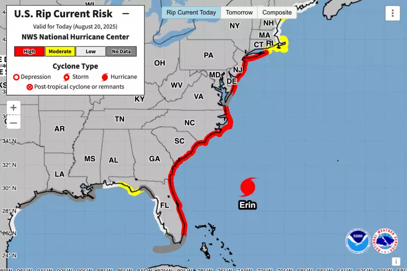
The Atlantic hurricane season has roared to life with the formidable force of Hurricane Erin, the first named storm of 2023, currently churning up the ocean and presenting a significant meteorological spectacle.
Satellite data and buoy readings have confirmed that Erin is generating monstrous waves, with heights skyrocketing to a staggering 50 feet (15 metres). These colossal walls of water are not just a danger to shipping lanes but are a precursor to the devastating storm surge that accompanies a hurricane's landfall.
A Path of Intensifying Danger
According to the latest advisory from the US National Hurricane Center (NHC), Erin is rapidly intensifying. Forecasters are closely monitoring its trajectory as it moves through the Atlantic. While its exact path towards land remains uncertain, current predictive models suggest it could pose a threat to coastal areas in the coming days.

The NHC has emphasised that all residents along the eastern seaboard should closely monitor the storm's progress and begin reviewing their hurricane preparedness plans. The combination of high winds, torrential rainfall, and a powerful storm surge makes Erin a particularly dangerous system.
Understanding the Power: Storm Surge vs. Waves
It is crucial to distinguish between the huge waves already being measured and the impending storm surge. The 50-foot waves are a product of the hurricane's extreme winds violently agitating the ocean's surface.
However, the storm surge is an entirely different phenomenon. It is an abnormal rise of water generated by a storm, over and above the predicted astronomical tides. This surge is caused primarily by the hurricane's winds pushing water towards the shore. When combined with the normal tides, the storm surge can cause catastrophic flooding, erode beaches, and destroy infrastructure. The energy from Erin's massive waves is a clear indicator of the potent storm surge it will carry with it.
Staying Informed and Prepared
Authorities urge the public to rely on official sources for information, such as the NHC and local National Weather Service offices. As Hurricane Erin continues to develop, further warnings and watches will likely be issued.
Now is the time for vigilance. Ensuring you have an emergency kit, knowing your evacuation zone, and heeding all advice from local officials are the best steps to ensure safety as this powerful storm continues its path across the Atlantic.


