
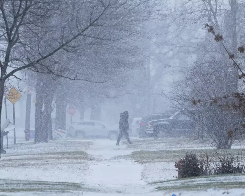
A powerful and rapidly intensifying winter storm, meeting the criteria for a bomb cyclone, has wreaked havoc across vast swathes of the United States, bringing treacherous conditions, widespread power cuts, and life-threatening cold.
Widespread Disruption and Treacherous Travel
The severe weather system slammed into the Plains and Great Lakes on Monday 29 December 2025, with a dangerous mix of sharply colder air, strong winds, snow, ice, and rain. The disruption was immediate and severe, creating hazardous travel conditions across multiple states.
By Tuesday morning, the national impact was starkly clear. Data from Poweroutage.us showed that more than 120,000 customers were without electricity, with Michigan accounting for nearly a third of all outages. The storm's ferocity was exemplified in Buffalo, New York, where a wind gust of 81 mph (130 km/h) was recorded, toppling trees and power lines.

Record Snowfall and Dramatic Lake Effects
Forecasters warned that some areas in western and upstate New York, which already saw a foot or more of snow on Monday, could see accumulations reach up to 3ft (91cm) by the week's end. The blustery winds compounded the arctic chill, with freezing temperatures dipping as far south as the Florida panhandle.
The storm's winds had a dramatic effect on the Great Lakes. On Lake Erie, fierce gusts pushed water towards the eastern end near Buffalo, causing a surge that clogged waterways with debris. Conversely, water receded dramatically on the western side in Michigan, exposing normally submerged lakebed. Kevin Aldrich, 33, from Monroe, Michigan, reported seeing historic wooden pilings from 1830s piers revealed for the first time.
"Where those are at would typically be probably 12ft deep," Aldrich said, highlighting the extreme shift. On Lake Superior, waves were predicted to reach 20ft (6 meters), forcing cargo ships to seek shelter.
Coast-to-Coast Impacts and a Soggy Rose Parade
The extreme weather was not confined to the east. In North Dakota and Minnesota, wind chills plunged to a bone-numbing -30°F (-34°C). Meanwhile, on the West Coast, strong Santa Ana winds with gusts over 70 mph downed trees in southern California, where saturated soil from recent rains made them vulnerable.
Looking ahead, the National Weather Service predicted further snow squalls for the eastern US as the main system moved into Canada. Although meteorologist Andrew Orrison stated the worst was likely over, officials continued to urge caution. New York Governor Kathy Hochul warned residents in impacted areas to avoid all unnecessary travel.
The unsettled pattern threatens to put a damper on New Year's celebrations. Forecasts indicate that rain on New Year's Day could soak the iconic Rose Parade in Pasadena for the first time in about two decades, marking a wet end to a tumultuous weather period for the nation.


