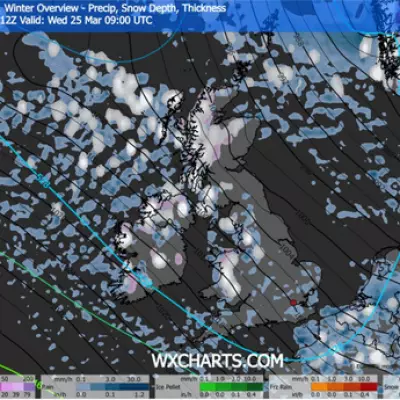
The United Kingdom is preparing for a severe bout of winter weather as dramatic new forecast maps indicate a major Atlantic storm is set to strike later this month. The system, predicted to arrive on Tuesday, January 27, is expected to bring a dangerous mix of heavy snow, torrential rain, and potentially destructive winds gusting up to 90mph inland.
Weather Maps Paint a Dramatic Picture
Charts from WXCharts show the fast-approaching storm developing over the Atlantic. A map for 6pm on January 27 reveals vast areas of the country blanketed in blue and purple shading, signalling widespread snowfall. Scotland, Northern Ireland, northern England and parts of the Midlands are under the thickest snow, particularly over higher ground.
Meanwhile, Wales, central and southern England, including London and the South East, are braced for persistent and heavy rainfall, with sporadic wintry showers adding to the disruptive conditions.
Powerful Winds to Lash the Nation
A second map for the same time highlights the extreme wind threat. Large swathes of the UK are coloured deep orange and red, indicating widespread gusts of 70mph to 90mph across England and Wales, even well inland. The most intense winds are forecast for Atlantic-facing coasts, with western Scotland, northwest England and Ireland potentially experiencing gusts exceeding 100mph.
The storm is predicted to reach its peak intensity over the ocean, where wind speeds could briefly touch 110mph, before weakening as it makes landfall.
Which Areas Will Be Spared?
Despite the widespread impact, the forecast suggests just 10 counties will be largely protected from the worst of the rain or snow at 6pm on January 27. These are primarily located in southwest England and west Wales.
The counties expected to be mostly spared are:
- England: Cornwall, Devon, Dorset, Somerset, Wiltshire, Gloucestershire.
- Wales: Pembrokeshire, Carmarthenshire, Ceredigion, Powys.
Official Forecast and Long-Range Outlook
The Met Office's long-range forecast for the period covering January 24 to February 2 aligns with this disruptive picture. It states the UK will sit in a "battleground" between Atlantic systems and high pressure to the north.
This setup is likely to bring further spells of heavy and persistent rain, especially in the south and west, with drier interludes in the far north. The Met Office also notes it will turn "somewhat colder" through this period, increasing the risk of snow, particularly on hills in Scotland and northern England.
The forecasting body cautions about the inherent uncertainty when looking more than five days ahead, noting that "small events currently over the Atlantic can have potentially significant impacts on our weather in the UK and Ireland in several days' time."


