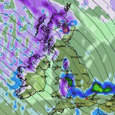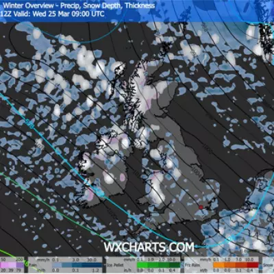
Fresh snow maps have ignited hopes for a white Christmas across parts of England, with a forecasted 48-hour Arctic blast threatening to blanket up to ten counties over the festive period.
Christmas Day Snowfall Predictions
According to the latest data from WXCharts, which utilises MetDesk information, several areas could wake up to a dusting of snow on the morning of December 25th. In a rare event for the region, parts of the South East, including Kent and Suffolk, may see snow settle on Christmas Day.
The northern reaches of England are also in line for festive flurries, with areas in and around the Pennines forecast to receive snowfall. The official Met Office definition of a white Christmas requires snow to fall at any point on December 25th, not necessarily settle, meaning these predictions could deliver the real thing.
Boxing Day Follow-Up and Long-Range Forecast
The wintry conditions are expected to persist into Boxing Day. Weather models suggest snow will appear over large swathes of South West England, particularly between Plymouth and Exeter, while continuing over the Pennines.
In its long-range forecast for December 21st to 30th, the Met Office indicated that unsettled conditions would likely continue initially, with low pressure to the southwest. This setup is expected to establish a broadly easterly flow, with rain or showers becoming confined to southern parts.
The forecaster added that high pressure will then become more dominant, leading to drier weather. However, from Boxing Day onwards, overnight frost and fog or freezing fog could become more widespread across the UK.
Rarity of a Southern White Christmas
While snow on Christmas Day is more common in the North West—occurring in nearly 40% of years since 1960—it remains a rare novelty in the South East. London has witnessed only five white Christmases since 1960, with the last one occurring over two decades ago in 2001.
The counties identified by the snow maps as potentially affected between Christmas Eve and Boxing Day are:
- Kent
- Suffolk
- Devon
- Northumberland
- County Durham
- Tyne and Wear
- North Yorkshire
- West Yorkshire
- South Yorkshire
- Cumbria
The current weather picture shows a foggy and frosty start for some in the southeast, with rain arriving from the northwest accompanied by coastal gales. The Met Office has issued a yellow weather warning for fog across South East England, the East of England, the East Midlands and South West England, including London, valid until 10am today. A separate yellow warning for rain remains in place for South West England and Wales.


