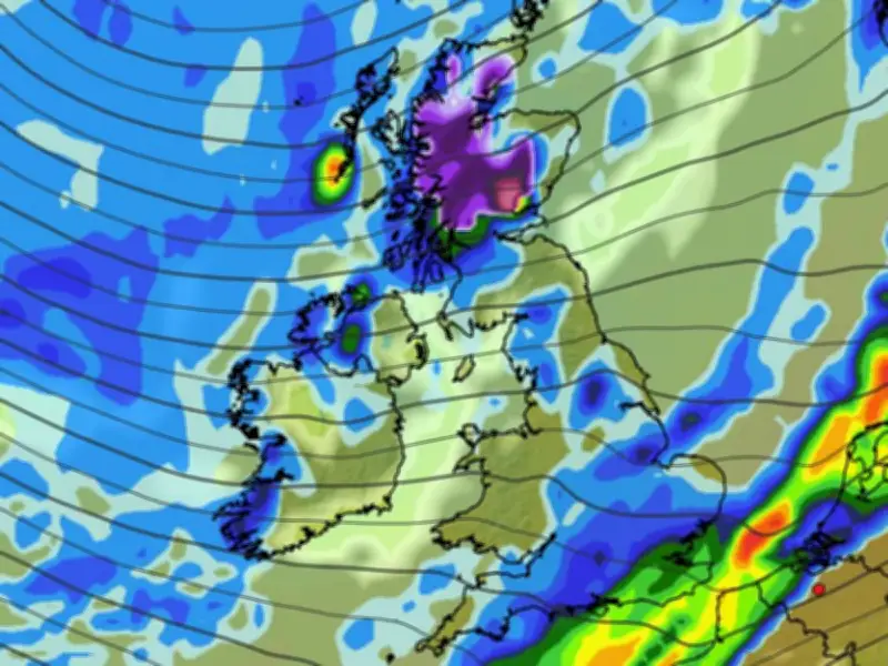
Weather modelling data suggests the first snow of the season may be just days away from landing in the UK, with up to 5cm possible on Scotland's highest peaks.
The GFS weather model shows the first snow of the season falling on October 16 and October 17. The data suggests this snow will only impact central and northern Scotland, settling only over higher ground, with 5cm possible on Scotland's highest peaks.
Eleven counties could see snow
In total, the GFS model data shows 11 counties in Scotland could see snow next month. The counties facing snow in October are Sutherland, Ross-shire and Cromartyshire, Inverness-shire, Nairnshire, Banffshire, Aberdeenshire, Angus, Perthshire, Argyllshire, Dunbarton and Stirlingshire.
In recent weeks, weather forecasters have warned that this year's El Nino - expected to be the strongest in living memory - could lead to some extreme wintry conditions over the coming months.
How El Nino could bring snow
The Met Office has said El Nino may lead to the polar vortex weakening, which in turn could cause Sudden Stratospheric Warming (SSW). Despite its name, SSW can lead to extreme cold and heavy snow - and was responsible for the 'Beast from the East' in 2018.
Thankfully, there are no indications that such an extreme weather system is coming to the UK anytime soon. However, SSW refers to rapid warming (up to about 50C) in the stratosphere, between 10km and 50km above the Earth. This process leads to cold air rushing downwards and impacting the jet stream, which can cause a 'blocking pattern' that keeps snow and cold weather locked in place for an extended period.
Although SSW doesn't always result in a major blast of snow, the Met Office says a cold snap "follows more often than not". As well as the Beast from the East in 2018, it also led to extreme cold and snow in 2009-10 and 2013.