
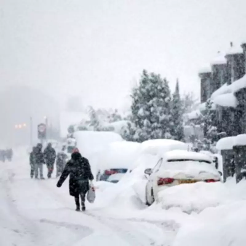
UK Snow Maps Reveal Blizzard Threat Next Week as Nation Braces for Heavy Snowfall
The United Kingdom is on high alert as weather forecasts predict a significant blizzard and heavy snowfall set to strike next week. Snow is expected to commence on Wednesday evening and persist into Thursday, February 19, with accumulations potentially reaching up to 25 inches in certain regions. The Met Office has already issued multiple weather warnings for snow and ice across the country, underscoring the severity of the impending conditions.
Timeline and Impact of the Snowstorm
According to the ECMWF weather model, snow and heavy rain could begin affecting the UK as early as midnight on Wednesday night. Initial impacts are forecast for Northern Ireland, Wales, and western parts of England. By Thursday morning, the snowfall is expected to spread across much of central and northern England, with Scotland also experiencing flurries. Major cities such as Cardiff and Glasgow may see snowfall from the early hours, intensifying throughout the day.
Roads and transport links could be severely affected, prompting authorities to urge residents to exercise extra caution while travelling. In areas where snowfall is most intense, data suggests it could fall at a staggering rate of up to four inches per hour. Although the snow is anticipated to ease after 6am, millions of people could wake to significant accumulations, with snow coverage charts indicating that almost every part of the UK—except for the southernmost regions of England—will have snow settled on the ground by Thursday morning.

Forecasted Snow Accumulations by Region
Depth charts reveal that several inches could accumulate in many areas, with specific forecasts including:
- Low-lying areas of Scotland: 7cm (2.8 inches)
- North Pennines: 9cm (3.5 inches)
- Wales: 8cm (3.1 inches)
- Midlands: 6cm (2.3 inches)
Additionally, a blizzard is forecast to sweep across the west coast of Scotland and northern England from around 6pm on Thursday, stretching from Glasgow to Carlisle. This could exacerbate travel disruptions and create hazardous conditions.
Broader Weather Patterns and Risks
BBC Weather notes that these wintry conditions are part of a temporary cold spell, with high pressure to the north likely weakening by the end of the week. This shift may allow south-westerly winds to bring milder air across the UK, although Scotland is expected to remain slightly cooler than average. The more Atlantic-influenced pattern in the south and west is likely to bring wet and windy conditions later in the week, raising the risk of local flooding in parts of southern and south-western England and South Wales.
Snow could appear on the colder leading edges of these rain bands, particularly over higher ground in northern areas. Meteorologists warn that Thursday’s snow may lead to widespread travel disruption and advise anyone planning to be on the roads to check forecasts and drive with caution. A yellow snow warning is in force for parts of the UK, highlighting the potential for dangerous conditions during the morning and early evening hours.
Preparations and Safety Advice
High pressure is expected to build over the eastern Atlantic between weather systems, delivering brighter but chillier interludes, with wintry showers possible on north to north-westerly winds, particularly in Scotland and northern England. Residents should prepare for a day of wintry conditions and monitor local updates as the storm develops. Authorities emphasize the importance of staying informed and taking necessary precautions to ensure safety during this severe weather event.


