
The Met Office has issued a significant weather update, indicating that this week could deliver the hottest day of the year so far across the United Kingdom. Advanced meteorological models predict a notable heat surge, with temperatures expected to climb well above seasonal averages, particularly on Wednesday and Thursday.
Temperature Anomalies and Regional Impacts
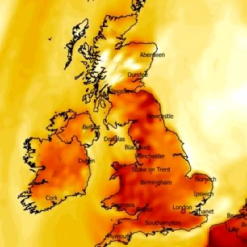
Weather anomaly maps reveal extensive areas of deep red, signalling where temperatures will exceed typical levels for early March. These conditions are projected to blanket much of England, Wales, Northern Ireland, and Scotland, with Thursday anticipated to be the peak of this warm spell. According to the Met Office, as meteorological spring commences, Thursday might officially become the hottest day recorded this year.
Detailed Forecast and Comparisons
High pressure is set to build from Tuesday, driving maximum temperatures from 14C up to 16C on Wednesday, and potentially peaking at 18C on Thursday. This would place the UK warmer than several European holiday destinations, including Ibiza, where forecasts suggest highs of only 14C for the same day. Met Office meteorologist Kathryn Chalk provided a breakdown: Tuesday will be largely settled with sunshine in Northern Ireland, northern England, and Scotland, though southern regions may see drizzly showers.

Wednesday is expected to be fine for most, with optimal sunshine in Wales and England, while Northern Ireland and south-west Scotland could experience cloud and rain. The warmth will intensify on Thursday, with the south-east of England likely seeing highs of 18C and sunny spells, though western areas may face outbreaks of rain.
Historical Context and Future Outlook
Last week, temperatures reached 18.7C in Kew Gardens, marking the previous hottest day of the year. There is a possibility that Thursday could surpass this record, according to forecasters. Looking ahead, Friday is predicted to be mostly dry with maximum temperatures around 14C.
In a complementary forecast, the BBC Weather service notes that Wednesday will be predominantly dry with sunny intervals and some cloud cover, accompanied by overnight fog patches and early frosts in northern parts. Thursday may turn more unsettled with rain moving in from the west, though the east and south-east should remain dry and bright. Friday could bring variable cloud and sporadic rain in the north-west and south-east regions.


