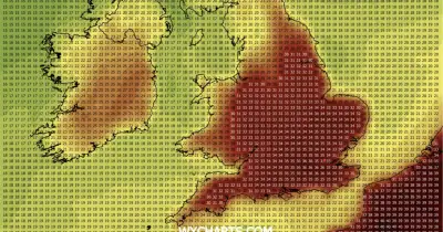
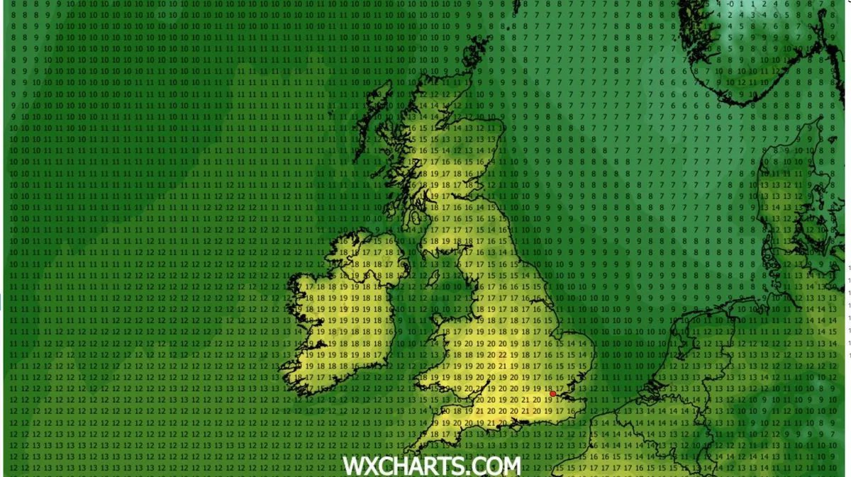
UK Weather Maps Glow Bright Yellow for 21C Scorcher as 13 Regions Set to Outshine Greece
Weather maps across the United Kingdom have turned a vivid shade of yellow, signalling the arrival of a significant heatwave that will see temperatures soar to a scorching 21 degrees Celsius in numerous regions. Remarkably, this impending warm spell is forecast to make much of the UK hotter than Greece next week, with a total of thirteen specific areas across England and Wales expected to experience these elevated conditions.
Detailed Regional Forecast and Temperature Comparisons
According to the latest data from WXCharts, which utilises information from MetDesk, the peak of this heatwave is projected for Wednesday, April 29. On that day, widespread areas of the UK are anticipated to reach 20C, with several locations climbing even higher. In a striking contrast, much of Greece is only forecast to achieve highs of 19C on the same date, placing the UK in a comparatively warmer position.
The south of England is naturally poised to bask in generous sunshine, but the Midlands region is predicted to record the absolute hottest temperatures. Specifically, the counties of Sussex and Surrey could see the mercury rise to 21C, while London may experience slightly cooler conditions. Even more notably, Staffordshire, Warwickshire, and the West Midlands have forecasts indicating the potential for localised temperatures hitting 22C.
Comprehensive List of Affected Regions
The thirteen regions across England and Wales forecast to reach 20C or higher are:
- West Sussex
- Surrey
- Hampshire
- Devon
- Somerset
- Gloucestershire
- Gwent
- Hereford
- Worcestershire
- West Midlands
- Warwickshire
- Wiltshire
- Staffordshire
Parts of Wales, including Gwent, are also expected to feel this pronounced warmth, with temperatures surpassing those in the Mediterranean nation. Further north, conditions will be somewhat cooler but still pleasant, with areas like Greater Manchester likely to experience spells of 19C throughout the day.
Broader Weather Patterns and Official Outlook
The warming trend is set to commence on Tuesday, with the Midlands again forecast to enjoy the best of the weather. The Met Office has provided a detailed outlook, indicating that high pressure will be centred close to or across the UK for much of this period. This meteorological setup is expected to result in largely dry conditions with extensive sunny periods.
The full Met Office forecast elaborates: "High pressure is likely to be centred close to or across the UK through much of this period. So many places will be largely dry with clear or sunny periods. Colder air will try to push into the country from the north toward next weekend, but will probably only make limited progress into the northeast for a brief time, where it could bring a short lived showery interlude, some of these wintry. Winds will be mostly light, but briefly stronger in the northeast as that colder air tries to come south. Temperatures will probably be near normal or slightly above for many, but with a risk of colder conditions affecting the north next weekend."
This forecast underscores a period of predominantly settled and warm weather for the majority of the UK, offering a welcome respite and conditions that are unusually favourable compared to southern European climates like Greece's for this time of year.


