UK Braces for Prolonged Snow Event as Arctic Air Descends
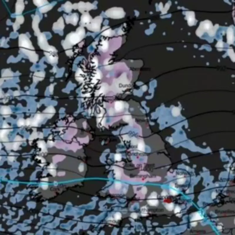
Fresh meteorological projections indicate that the United Kingdom is set to endure a severe and prolonged snow event later this month, with 16 major cities squarely in the firing line. According to the latest data from the ECMWF weather model, a brutal 78-hour period of snowfall is anticipated, driven by a combination of Arctic air moving southwards from Scandinavia and stalled low-pressure systems from the Atlantic.
Sustained Snowfall Predicted from Late February
Maps from WXCharts show that the sustained snow is expected to commence around 6pm on February 26, persisting over several days. This pattern, characterised by repeated waves of snow rather than a single passing storm, raises significant concerns for travel safety and infrastructure. Northern regions, in particular, are likely to experience on-and-off snowfall, leading to icy roads, hazardous driving conditions, and widespread travel disruption.
The first showers are forecast to reach Scotland on the evening of February 26, with a stronger band pushing southwards the following day. This will turn to snow across colder northern areas and higher ground, with wintry showers continuing through February 28 and until midnight on March 1 as cold air remains entrenched.
Regional Impacts and Risk Areas
While southern England may stay closer to milder Atlantic air, with rain or sleet more probable, brief overnight wintry bursts cannot be ruled out. Higher ground in Scotland is most likely to see the deepest accumulations, whereas lower-lying towns may experience temporary coverings followed by treacherous icy conditions.
The Met Office's prediction for the period from February 20 to March 1 suggests unsettled weather with "some snow probable at times," especially on high ground in the north. Their forecast reads: "Showers or longer spells of rain, as well as occasional strong winds, are most likely at first as Atlantic low pressure systems dominate in the vicinity of the UK. Some heavy rain is likely in places, with some snow probable at times, mainly on high ground in the north."
List of Cities in the Snow Danger Zone
- Scotland: Glasgow, Edinburgh, Aberdeen, Dundee, Inverness
- Northern England: Newcastle, Carlisle, Durham, Leeds, Sheffield, Manchester
- Fringe Risk Areas: Liverpool, Stoke-on-Trent, Nottingham, Birmingham, Belfast
This weather pattern resembles a classic cold northerly setup, with low pressure lingering near the UK while Arctic air feeds southwards. As the nation prepares for this significant winter event, authorities are urging residents to stay informed and take necessary precautions to ensure safety during the anticipated disruptions.


