
Rare March Blizzard Forecast to Sweep Across UK, Targeting Major Cities
Meteorological winter may be ending this week, but a final wintry surprise could be in store for the United Kingdom. Advanced weather forecasting maps are now indicating the potential for a rarely-seen March blizzard to move across the country at the start of next month, potentially burying several major cities in snow.
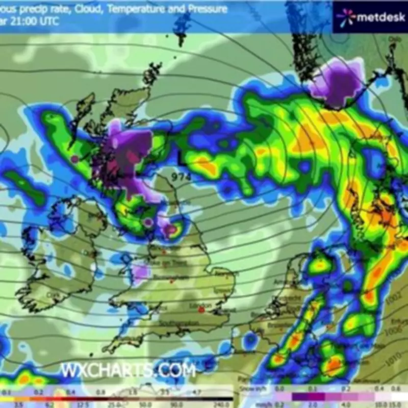
Snowfall Timeline and Geographic Spread
According to the GFS weather model, the initial snowfall is expected to begin over Scotland, northern England, and North Wales at approximately 9pm on March 5. Glasgow is likely to be in the direct firing line initially in Scotland, while in England and Wales, the early snow is anticipated primarily over higher elevations and hills.
The blizzard system is then projected to track southward, bringing the possibility of snow to larger population centres. By 6am on March 6, the forecasting maps suggest snow could be falling in Newcastle and parts of Yorkshire, including Leeds. Further progression by 9am may see flurries reaching Manchester as well.

Snow coverage maps indicate that a significant swathe of northern England and Scotland could be covered by 3pm on March 6. However, accumulations in most lowland urban areas are not expected to exceed 1cm to 2cm, with deeper snow likely confined to hills and elevated terrain.
Official Forecasts and Conflicting Predictions
The Met Office forecast for the period from February 28 to March 9 acknowledges that snow "is possible," but primarily over higher ground in northern regions. The national weather service also predicts "changeable conditions" are likely in most places, interspersed with some "drier and brighter interludes."
The Met Office expects the heaviest rainfall to occur in the north-west at the beginning of March. They add: "Winds will probably be strong at times, with a risk of gales. Temperatures are likely to be near to or slightly above average."
In contrast, the BBC forecast for the start of March suggests snow is possible but unlikely. Their outlook for March 2 to 15 states: "Although confidence is even lower than usual for this period, there are some signs of high pressure building near the UK, leading to somewhat drier conditions, with precipitation amounts near or below average."
The BBC forecast elaborates: "However, the position of this potential high will have a notable influence on both precipitation and wind. It will most likely linger near the UK through the first week of March, bringing relatively dry conditions, along with a risk of frost and fog. Daytime temperatures should be at least near seasonal for most areas, and potentially above average, although some chillier conditions are possible across Scotland."
They note a small chance that high pressure could develop at higher latitudes, which would bring a risk of a colder week, though strong cold anomalies would not be expected. In such a scenario, wintry showers would then become more likely.
Context and Implications
This potential weather event is notable for its timing in early March, a period when blizzards are relatively uncommon in the UK. The conflicting forecasts from different models highlight the uncertainty inherent in long-range weather prediction, particularly for extreme events.
Residents in the affected regions, especially in major cities like Glasgow, Newcastle, Leeds, and Manchester, are advised to monitor updated forecasts closely as the date approaches. While significant disruption is not currently anticipated from the predicted snow accumulations, the combination of precipitation, strong winds, and potential temperature variations could create challenging conditions for travel and daily activities.


