Met Office Confirms Hottest Day of 2026 Amid Foehn Effect Phenomenon
The Met Office has officially declared today, March 18, 2026, as the hottest day of the year so far, attributing the spike in temperatures to the little-known Foehn effect. According to the national weather agency, the mercury soared to a remarkable 20.9°C in Gogerddan, Wales, this afternoon, surpassing the previous record of 19.2°C set on March 5 in London. In the capital, temperatures reached 20.2°C, marking a significant departure from seasonal averages.
Understanding the Foehn Effect and Its Impact
The Met Office explains that the Foehn effect occurs when moist air is forced up one side of a mountain, cooling as it ascends. Upon crossing the peak, the air descends rapidly, warming up and leading to unusually high temperatures on the downward slope. In the UK, this phenomenon is most commonly observed in the Scottish Highlands, where westerly winds from the Atlantic bring wet conditions to the west while the east enjoys warmer, sunnier weather. Globally, similar effects are known as ‘the Chinook’ in the Rocky Mountains and ‘the Zonda’ in the Andes.
Immediate Forecast: Warmth Followed by a Chilly Turn
Despite today's heat, the Met Office warns that conditions are expected to turn chilly later tonight and into tomorrow morning. However, most areas will still experience a warm and sunny day tomorrow, with temperatures rising to around 17°C or 18°C widely. Looking ahead to the weekend, the forecast indicates dry weather with sunny spells for many, though northern Scotland faces a risk of rain on Saturday, potentially spreading more widely in the north by Sunday, accompanied by cooler temperatures.

Long-Term Outlook: Colder Snap and Snow Potential
Beyond the immediate warmth, the Met Office predicts a shift to more changeable and unsettled conditions from March 22 to March 31. Atlantic frontal zones are expected to cross the UK, with the north likely to see the most active weather, while the south remains under the influence of a ridge of high pressure. This pattern could lead to a briefly widely colder interlude with northerly winds during the final week of March, bringing the potential for snow, especially in northern regions. Additionally, strong winds may develop around this time, with high pressure potentially dominating by month's end, resulting in dry weather but risks of overnight fog and frost.
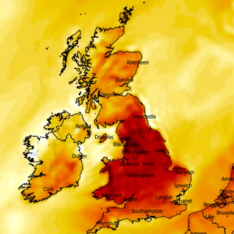
Temperature anomaly maps illustrate today's spike well above seasonal norms, highlighting the dramatic weather fluctuations. As Brits enjoy the unexpected warmth, they are advised to stay informed about the impending colder conditions and possible snowfall, underscoring the UK's unpredictable climate patterns.