
Severe Weather Alert: Northern UK Braces for Easter Weekend Gale-Force Winds
The Met Office has escalated warnings as a significant weather system threatens to unleash gale-force winds across the northern half of the United Kingdom over the Easter weekend. A yellow weather warning is now in effect, highlighting the risk of severe disruptions from Saturday evening through to midday on Sunday.
Forecast Details and Potential Impacts
Meteorologists predict that wind gusts will range from 50 to 60 mph across many areas, with exposed locations potentially experiencing speeds of 60 to 70 mph. In western regions of Scotland, gusts could escalate dramatically, reaching between 80 and 90 mph. This intense weather pattern is attributed to a significant cold plunge originating from Canada, which is driving into the North Atlantic and intensifying the jet stream.
The anticipated conditions pose substantial risks to travel and infrastructure. Commuters and holidaymakers should prepare for widespread delays affecting road, rail, air, and ferry services, with some cancellations likely. High-sided vehicles are particularly vulnerable on exposed routes and bridges, where closures may be enforced as a precautionary measure.

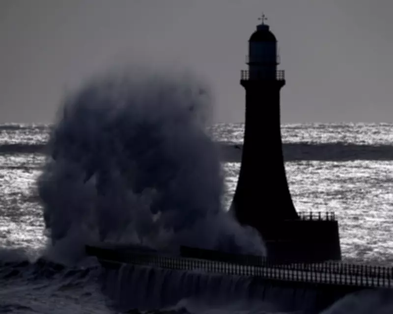
Broader Disruption and Safety Concerns
Beyond transportation, the strong winds carry the threat of power cuts and disruptions to essential services, including mobile phone coverage. Structural damage is also a concern, with the potential for tiles to be dislodged from roofs and other building materials to become hazardous.
Coastal areas face additional dangers, as large waves and beach material could be violently thrown onto seafronts, coastal roads, and properties. The Met Office has cautioned that there is a small chance of injuries resulting from these conditions, urging the public to exercise extreme caution near shorelines.
Expert Insights and Weekend Outlook
Dan Holley, the Met Office's deputy chief meteorologist, explained the meteorological dynamics at play. "A significant cold plunge from Canada into the north Atlantic will impact our weekend weather, strengthening the jet stream and spinning up a deep area of low pressure towards the north-west of the UK on Saturday night," he stated. "This will lead to a spell of very strong winds later on Saturday and overnight into the morning of Easter Sunday."
Holley added that winds are expected to gradually ease throughout Easter Sunday as the low-pressure system moves into the North Sea. Meanwhile, Tom Morgan, an operational meteorologist at the Met Office, noted that while much of the UK will experience unsettled weather by the end of the week, it does not necessarily indicate a complete washout for the Easter weekend.
Contextual Weather Trends for March
This warning comes amid broader climatic observations. Recent figures from the Met Office reveal that March was provisionally one of the warmest on record in England and Wales. Wales recorded its joint fourth warmest March, while England experienced its joint sixth warmest since comparable data began in 1884. Across the entire UK, it ranked as the joint tenth warmest March on record.
However, rainfall patterns showed a pronounced north-south split last month. Southern England saw 37% less precipitation than the long-term average, whereas northern England and Scotland recorded 14% and 19% above average rainfall, respectively. This disparity underscores the variable weather conditions affecting different regions of the country.
As the Easter weekend approaches, residents and visitors in the northern UK are advised to stay informed through official updates and take necessary precautions to ensure safety amidst the challenging weather forecast.


