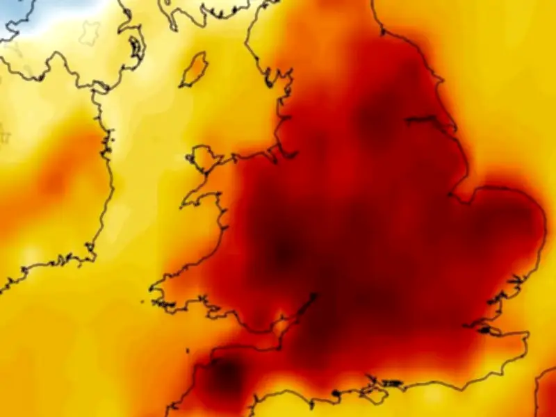
Britain is set for another scorching spell following a welcome bout of rainfall and thunderstorms that swept across the nation. Temperatures are set to dip into the low-20s over the weekend. However, fresh data indicates the mercury will surge again as next week draws to a close.
Forecast highs and timing
The GFS weather model predicts temperatures could hit 28C across southern and western England on September 5, with similar peaks potentially spreading more broadly – reaching as far north as Yorkshire – on September 6. Come September 7, the thermometer might soar to 29C in eastern and western England, with highs of 27-28C looking highly likely across central and southern regions.
While these figures aren't quite as blistering as those seen earlier this year, they would still satisfy the requirements for an official heatwave in certain areas.

Heatwave definition and regional thresholds
The Met Office classifies an official heatwave as occurring when temperatures hit the "heatwave threshold" for three consecutive days, reports Yorkshire Live. This threshold sits at 28C in the south-east, where conditions tend to be hotter, and drops to 25C the further one moves away from the south-east, reports the Daily Star.
Temperature anomaly maps for this period show England and Wales bathed in red and orange hues, indicating areas where temperatures will significantly exceed the seasonal average.
Met Office outlook and rainfall expectations
The Met Office has predicted "very warm spells" at the beginning of September, particularly across southern regions. Nevertheless, significant rainfall is also anticipated.
The Met Office's forecast from August 31 to September 9 states: "Likely remaining unsettled with showers or longer spells of rain across all areas at times. Rainfall amounts will probably be above average for the time year with the wettest conditions in the northwest."
"Potential for some strong winds at times. Some drier and more settled interludes could develop, perhaps becoming longer in duration across southern areas later in this period. Temperatures are likely to be near average, although some short-lived warm or very warm spells are possible, especially in the south."
Summer records and drought concerns
This summer has surpassed the previous record of 19 days set in 1995. New data from the Copernicus Climate Change Service shows that Western Europe has endured its hottest June on record, with temperatures averaging 20.74C around the clock - surpassing the long-term average by more than 3C.
Experts caution the impact goes far beyond sweltering nights and packed beaches. Despite a soggy winter, the extreme heat has sparked what's being described as a "new type" of drought - with intense evaporation sapping moisture from rivers, reservoirs and farmland.