
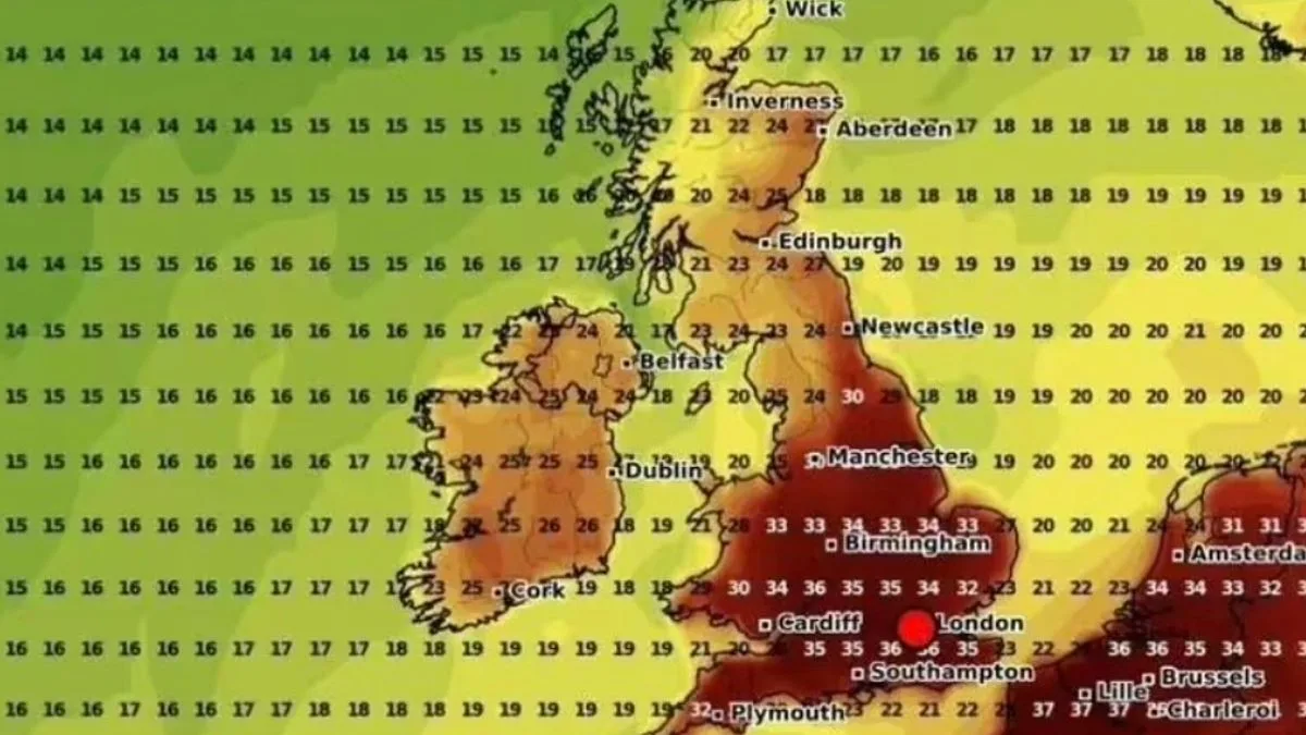
Another heatwave is on the horizon for the UK, with temperatures expected to rocket up to 36C. Weather maps from WXCharts show that from August 13, the mercury will dramatically rise, potentially marking the fourth heatwave of the summer after weeks of rain and thunderstorms.
The heat will initially hit Kent the hardest, with temperatures reaching 30C by 6pm on August 13. London and surrounding areas, along with Suffolk and Norfolk, are forecast to reach 29C. In the West, Gloucestershire and Somerset will see 27-28C, while Devon, Cornwall and the Midlands will experience highs of 26-27C. The north of England, Scotland and Northern Ireland will narrowly miss the initial blast but will remain warm.
By August 14, temperatures across the entire nation will climb higher. The southeast of England will swelter at 33C by 6pm, with London and the home counties expected to be the hottest. The southwest will hit a minimum of 29C. Birmingham will reach 30C, Cardiff 29C, Manchester 27C, while the north of England and Scotland will be slightly cooler at up to 22C.
On August 15, the three-day scorcher peaks with temperatures soaring to 36C. The southeast bears the brunt: London, Surrey, Sussex and Gloucestershire are forecast to hit 36C at 6pm. Kent, Wiltshire, Hampshire and Somerset will endure 35C, with similar temperatures as far north as Birmingham. Cornwall climbs to 32C, Cardiff swelters at 34C, the Midlands average 33-34C, and Manchester to Newcastle will see 30C. Scotland peaks at 27C, Northern Ireland at 24C.
The Met Office's long-range forecast mirrors these predictions, stating: "Above-average temperatures overall seem most likely, with the potential for hot spells to develop, especially in the east and south, these more probable further into August."




