Large parts of popular British coastal towns could face regular flooding by 2050 as human-caused sea level rise intensifies extremes, according to Climate Central's interactive maps. The projections, based on mid-range emissions scenarios and advanced elevation modelling, highlight low-lying areas in beloved seaside destinations as increasingly vulnerable.
Weston-super-Mare Under Threat
Climate Central's maps flag large areas of this Somerset resort – including its famous beach, Grand Pier and seafront – as potentially below annual flood levels by 2050 under a mid-range scenario. The Bristol Channel's massive tidal range heightens the risk to homes, businesses and tourism infrastructure. North Somerset Council acknowledges sea level rise as a genuine long-term challenge but highlights existing sea walls and significant investment in flood management. It is developing a coastal transition plan with the Environment Agency to target future upgrades.
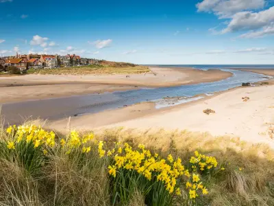
Lincolnshire and Norfolk Coasts
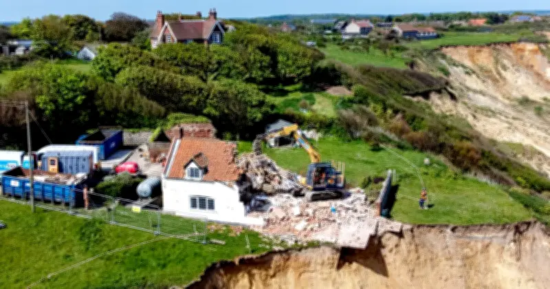
Low-lying stretches of eastern England are among the most exposed. Projections show extensive areas along these coastlines could see increased inundation, threatening holiday parks, nature reserves, farmland and communities long reliant on coastal defences. A house in Trimingham in Norfolk which was hanging off a cliff had to be demolished recently, underscoring the immediate risks.

Eastbourne and Southern Hotspots
In East Sussex, parts of Eastbourne and nearby low-lying zones appear vulnerable. Similar risks extend to areas near the Thames estuary and Dorset coastlines, where repeated flooding could reshape popular visitor destinations.
The Science Behind the Maps
A Science Advances paper published June 10, 2026 found human-caused sea level rise detectable at 97% of global tide gauges and responsible for 58% of extreme water level days from 2000-2018. It has nearly tripled such days since the 1970s on average. Daniel Gilford of Climate Central warned: “The effects of human-caused climate change are already here. We will continue to face growing threats like increasing coastal flood risks unless we immediately and sharply reduce our climate pollution.”
UK tide gauges confirm sea levels have risen over the past century with an accelerating rate. The maps combine elevation data with IPCC projections but are screening tools that do not fully factor in all existing defences. A companion Nature Climate Change study indicated human-driven rise has quadrupled coastal extreme frequency since 1900. Robert Kopp of Rutgers University said sea level rise is making both tidal and storm flooding more frequent, extensive and expensive.
Adaptation and Funding
Councils stress ongoing maintenance and adaptation. Recent funding includes £50m for Somerset defences, but experts say sustained investment will be needed to maintain protection standards. The tool allows exploration of different emissions pathways, showing that near-term climate action will influence sea level outcomes for centuries. While not predicting inevitable loss, the maps underscore the need for both emissions cuts and resilient planning.