
Britons enjoying the recent springlike warmth are set for a disappointing weekend washout as temperatures are forecast to drop sharply and heavy rain lashes the country. New weather maps reveal an incoming mix of torrential downpours and bitter cold, potentially dipping below zero, which threatens to upend what has been a promising start to March.
A Sudden Shift in Conditions
Meteorological spring began on March 1, bringing sunshine and comparatively mild conditions that offered a welcome respite from the widespread deep chill that had gripped the nation. The mercury soared to an impressive 19.2°C in Northolt, west London, on Thursday, marking the highest temperature recorded so far this year. However, these sustained highs are not expected to last much longer.
Temperature Plunge and Rainfall Forecast
According to the latest weather maps from WXCharts, temperatures will start to dip next Friday, March 13, drifting back into the high single figures. Maximum temperatures are predicted to reach only 8°C, with the coldest areas—typically Scotland and Northern Ireland—seeing lows between 0°C and 1°C. London and the southeast will experience the highest temperatures, but even these will be significantly cooler than recent days.

The following day, Saturday, March 14, temperatures will split again from north to south, ranging between lows of 4°C and highs of 9°C. This drop coincides with a massive wave of rain descending over almost the entire country. The same maps show a huge band of rainfall arriving from the west at around 6am on Saturday, quickly blanketing the UK and leaving only the southern coast of England and northeast Scotland relatively dry.
Extended Period of Unsettled Weather
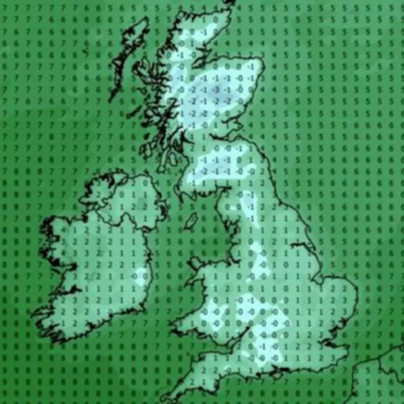
The rain is forecast to continue pounding until late on Sunday, with precipitation rates exceeding an inch per hour on the west coast. Scotland is expected to see a significant snow blanket persisting well into the afternoon. Temperatures on Sunday will increase slightly to between 10°C and 11°C in England, while remaining much lower in Scotland, around -1°C to 0°C. This trend will extend to the rest of the country by Monday, March 16, when the highest temperature in England could be just 2°C, and the Scottish Highlands might plummet to -3°C.
Met Office Long-Range Outlook
The Met Office long-range forecast, covering March 11 to March 20, indicates that conditions will likely be unsettled across the UK during this period. Despite the cold snap, temperatures could still be above average for the time of year. Forecasters explain that the UK will be located at the interface between high pressure across Europe and low pressure over the North Atlantic.
This setup means western areas will likely experience spells of rain and stronger winds, while eastern parts should see more dry interludes, though some rain is possible. Towards the middle of March, there is a signal for unsettled conditions to become more widespread, with all regions facing a higher chance of rain and stronger winds. Throughout this period, temperatures are expected to remain a little above average for most areas, despite the noticeable drop from recent highs.
This dramatic shift serves as a reminder of the unpredictable nature of British spring weather, where warm spells can quickly give way to cold and wet conditions. Residents are advised to prepare for the change by ensuring they have appropriate clothing and staying updated on local weather warnings.


