
UK Braces for Major Snowstorm with Up to Eight Inches of Snow Forecast
Britain is preparing for a substantial snowstorm this week, with advanced weather modelling indicating that up to eight inches of snow could blanket parts of the country. At least 18 cities are expected to be affected as temperatures plummet below freezing, with some regions forecast to experience lows of -6°C.
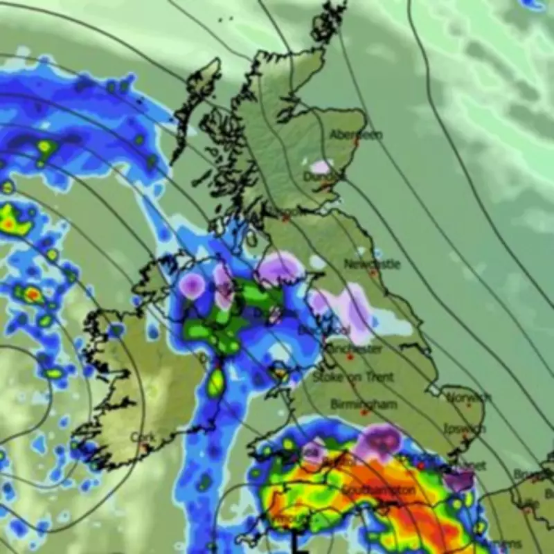
Timeline and Impact of the Incoming Snowstorm
The snowstorm is predicted to arrive in the UK by 6pm on February 18, with snowfall initially appearing in cities such as Oxford, Canterbury, and Swansea on Wednesday evening. By 9pm, the storm is forecast to intensify, particularly across Wales and the West Midlands, where Powys and Shropshire are expected to see the heaviest accumulations.
According to the ECMWF weather model, snow depths in these areas could reach up to eight inches by the early hours of Thursday morning. The West Midlands may record up to three and a half inches, while the Yorkshire Dales could face around three inches. Approximately 90% of Wales is shown to be blanketed on weather maps.

Cities and Regions at Risk of Heavy Snowfall
The following cities are among those poised to experience significant snowfall this week:
- Belfast
- Cardiff
- Swansea
- Birmingham
- Stoke-on-Trent
- Manchester
- Dundee
- Wrexham
- St Davids
- Sheffield
- Nottingham
- Derby
- Leicester
- Wolverhampton
- Coventry
- Canterbury
- Oxford
- Leeds
Northern areas, including Dundee, the Yorkshire Dales, and Dumfries and Galloway in Scotland, are also expected to receive a sprinkling of snow. In contrast, the majority of England and Wales, particularly Scotland and the southeast including London, Essex, and Kent, are set to remain dry by Thursday.
Weather Warnings and Broader Forecast
The Met Office has warned of an unsettled start to the week, with rain and heavy winds expected in the north. A forecaster stated, "Tuesday is expected to bring a drier, colder day for many before further rain returns from the southwest later." They added, "Through the second half of the week, the UK will remain unsettled, with spells of rain, strong winds and hill snow at times. Further weather warnings may be needed as conditions continue to evolve."
This snowstorm follows recent alerts from the Met Office, highlighting the ongoing volatility in winter weather patterns across the country. Residents in affected areas are advised to prepare for potential travel disruptions and hazardous conditions as the storm develops.


