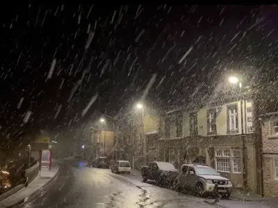
New weather maps suggest snow and freezing temperatures could develop across parts of the UK on Thursday, November 26, with overnight lows potentially falling to -4C in northern Scotland.
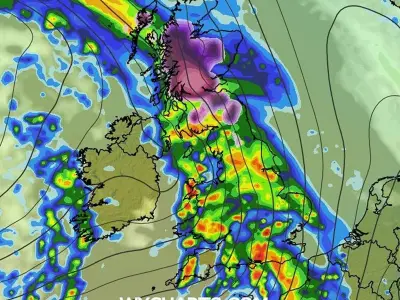
Charts from WXCharts, using ECMWF HRES 0.1 data, show bands of precipitation moving across parts of the British Isles. Separate temperature projections indicate the coldest conditions will be in northern Scotland, where some locations could see temperatures around -4C.
Where the Coldest Conditions Are Expected
The minimum temperature chart, valid for 6pm on Thursday, November 26, shows temperatures below zero in several areas of northern Scotland. Parts of central and southern Scotland could also experience freezing conditions, while northern England is forecast to see temperatures closer to zero.
Further south, temperatures look milder, with much of England and Wales remaining above freezing. However, overnight frost could become a concern in colder inland areas of southern England.
Wintry Precipitation and Areas to Watch
The ECMWF winter overview charts show the potential for wintry precipitation across parts of the UK on November 26. The maps indicate areas of precipitation around Scotland, Northern Ireland, Wales and parts of England, although the precise type of precipitation varies across the forecast.
Some of the wintry weather appears concentrated around western and northern areas, with Scotland among the regions to watch. The charts also show a developing area of low pressure to the east of Scotland, which could influence conditions across the northern half of the country.
Regions Most Likely to See Snow
The areas highlighted as ones to watch for snow include Highland, Argyll and Bute, Perth and Kinross, Aberdeenshire, Cumbria, Gwynedd, Powys and parts of Northern Ireland.
The forecast follows earlier reports of a potential -4C freeze across parts of the UK as colder weather moves in towards the end of November.