
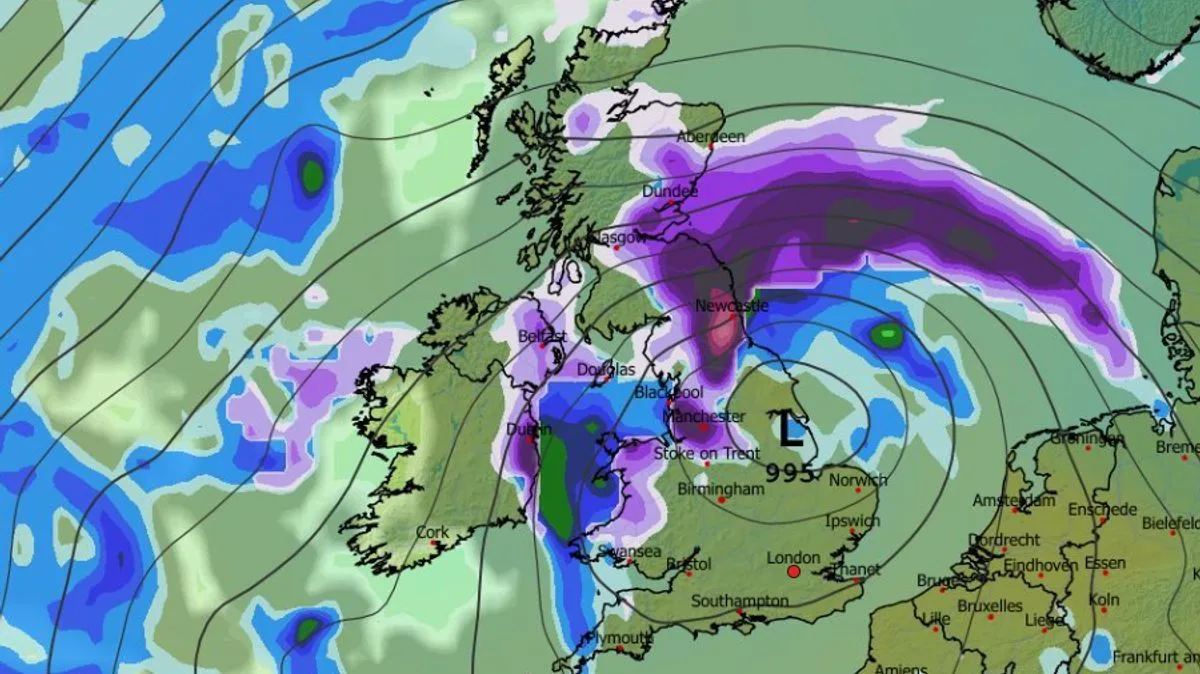
Weather maps suggest a 'Beast from the East' storm could bring heavy snow to the UK in February, with up to 26 inches (65cm) forecast in the Scottish Highlands. The GFS weather model shows a mass of snow forming to the east of Britain on February 8, which could collide with another weather front from the south, leading to widespread snowfall across the country.
Initial flurries in northern England and Scotland are expected to be light, but the maps indicate intense snowfall in southern England by midnight on February 8, with a large area of purple showing snow in the Midlands, Wales, northern England and Scotland. Cities including Birmingham, Manchester, Newcastle and Edinburgh appear to be in the firing line.
By midday on February 9, the maps suggest snow will have reached Northern Ireland, hitting Belfast. The heaviest snow is expected in the north-east of England around this time, with serious flurries also hitting the north-west. By midnight, Northern Ireland could experience the heaviest snow, while southern, central and north-eastern Scotland can expect snow throughout the day.
Snow coverage maps for 3am on February 10 show snow settled in parts of southern England, the Midlands, and across almost all of Wales, Northern Ireland, the north of England and Scotland. Snow depth charts suggest the Scottish Highlands could see 65cm (26 inches), the North Pennines 16cm (six inches), Northern Ireland 8cm (three inches) and North Wales 4cm (1.5 inches).
The Met Office also suggests snow could fall at the start of February due to weather fronts from the north-east and south-west colliding. Its forecast for February 1 to 10 states that cold air is likely to be positioned to the northeast, bringing wintry showers, with a risk of snow where fronts from the south-west reach the cold air.




