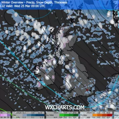
The Met Office has issued a stark warning for a dramatic weather showdown set to unfold across Britain, with two substantial regions poised to be blanketed by snow within the coming days. Forecasters describe an impending atmospheric "battleground" where vigorous Atlantic storms advancing from the west will confront resilient high-pressure systems entrenched in the north and northeast.
Intense Weather Confrontation Looms
This meteorological clash is expected to trigger a period of highly unsettled conditions, characterised by repeated bouts of rain and showers. Many of these precipitation events are predicted to be heavy and persistent, particularly impacting southern and western areas of the United Kingdom. In contrast, the far north and northwest may experience brief, welcome respites of drier and calmer weather.
Plunging Temperatures and Snow Risk
While milder air may occasionally filter into southern and western locales, a dominant trend towards colder conditions is anticipated as the forecast period progresses. This shift significantly elevates the risk of snowfall, with higher ground in Scotland and northern England identified as the primary targets. The Met Office's detailed long-range outlook, covering January 24th to February 2nd, explicitly highlights this threat.
The forecast warns that the ensuing icy conditions could lead to considerable travel disruption and hazardous driving situations across affected regions. Temperatures are projected to plummet, with lows potentially reaching -1°C in areas such as the eastern shore of Loch Long in Finnart and throughout the Cairngorms mountain range.
Current Context and Broader Impacts
This new alert arrives as Scotland grapples with its most significant snowfall in years, with northern parts of the country already submerged under several inches of snow. The situation is further complicated by the threat of flooding from melting ice, adding another layer of risk to the ongoing severe weather episode.
The official Met Office statement elaborates on the expected pattern: "The UK will likely continue to sit in the battleground between Atlantic weather systems attempting to push in from the west, but tending to stall in the vicinity of the UK as they encounter high pressure to the north and northeast."
It continues, "As such, further spells of rain or showers are likely at times, which may be heavy and persistent, especially in the south and west, with the best of any drier interludes in the far north and northwest. Whilst mild conditions will encroach into the south and west at times, it is likely to turn somewhat colder through this period, bringing the risk of some snow, more especially on hills in Scotland and northern England."
Residents in the highlighted regions are urged to stay informed through official weather updates and prepare for potential disruptions to daily life and transport networks as this potent weather system develops.


