
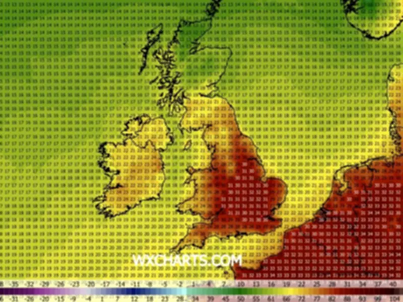
The GFS weather model shows temperatures rising later this month, with highs of 31C possible on August 11 across much of eastern, central and southern England, as well as parts of Wales close to the border. It comes after four heatwaves have already been recorded this year, and a fifth could be on its way.
An official heatwave is declared when temperatures hit the 'heatwave threshold' for three days in a row. The threshold stands at 28C in the South East and 25C in cooler areas such as Liverpool and the North West.
Temperatures could reach 35C in 11 counties
As The Mirror reports, GFS model data shows maximum possible temperatures could reach 35C on August 12 and remain above 25C until Saturday August 15, making this period an official heatwave. The Midlands and South East are expected to be the warmest regions, although 33C is possible as far north as Yorkshire.
The GFS model maps suggest 11 counties could reach 35C or more later this month: Warwickshire, Lincolnshire, Northamptonshire, Hertfordshire, Buckinghamshire, Oxfordshire, Gloucestershire, Worcestershire, Herefordshire, Surrey and Cambridgeshire. Temperature anomaly maps show temperatures will rise well above the seasonal average.
Heat alerts issued across England
The UK Health Security Agency has heat alerts in place for several areas of England from 9am on Sunday, August 2, until Wednesday, August 5 at 9am. These areas are the East Midlands, West Midlands, East of England, London, South East and South West.
The alert means minor impacts are likely across health and social care services, including increased use of healthcare services by vulnerable people, greater risk to life of vulnerable people, increased potential for indoor environments to become very warm and water-related incidents may increase, including risks from cold-water shock and drowning.
Liverpool forecast
Liverpool could reach a maximum temperature of 27C on August 10 and 11 before dipping slightly to 25C on August 12. For the rest of the week, temperatures in Liverpool will hover around the 22C mark.
In Liverpool today, the Met Office has forecast rain showers ending by 11am, replaced by clouds with sunny spells. This will last until 7pm, when there will be two hours of sunshine before sunset. Temperatures will hover around 18C for much of the day.
The Met Office's North West England weather forecast said: "Today: A fairly cloudy start with a few showers at times. Turning increasingly dry into the afternoon with some warm sunny spells. Light winds for most but breezy at the coast. Maximum temperature 18C."
"Tonight: Showers easing away this evening to leave a largely dry night with clear spells. Turning chilly for many with a few mist patches. Minimum temperature 4C."
"Sunday: A warm, dry and bright day with plenty of sunny spells and light winds. Clouding over in the evening perhaps with some outbreaks of rain. Maximum temperature 22C."
"Outlook for Monday to Wednesday: Turning very warm and humid from Monday with an increasing chance of showers. Feeling very warm in the sunny spells. A small risk of thunderstorms at times."




