
Met Office Issues Yellow Warning as Snow and Rain Set to Disrupt UK
The Met Office has issued a yellow weather warning for snow across eastern England, urging residents to prepare for potential travel disruption and hazardous conditions. Forecasters predict that rain which battered the UK on Sunday morning will transition to sleet and snow, with accumulations of up to 4 centimetres anticipated in some regions.
Targeted Snowfall in Eastern Regions
Meteorologists indicate that the heaviest snow is likely to affect the Lincolnshire Wolds, along with parts of Norfolk and Suffolk. However, this snowfall is expected to revert to rain later in the day. A series of weather warnings expired over the weekend, but a new snow alert remains active for sections of eastern England until 4 pm on Sunday.
The warning specifically notes that "a spell of snow may lead to some disruption to travel," highlighting risks for commuters and local services. Met Office meteorologist Liam Eslick commented that temperatures on Sunday evening should not fall below freezing overnight, minimising the risk of widespread frost in England.

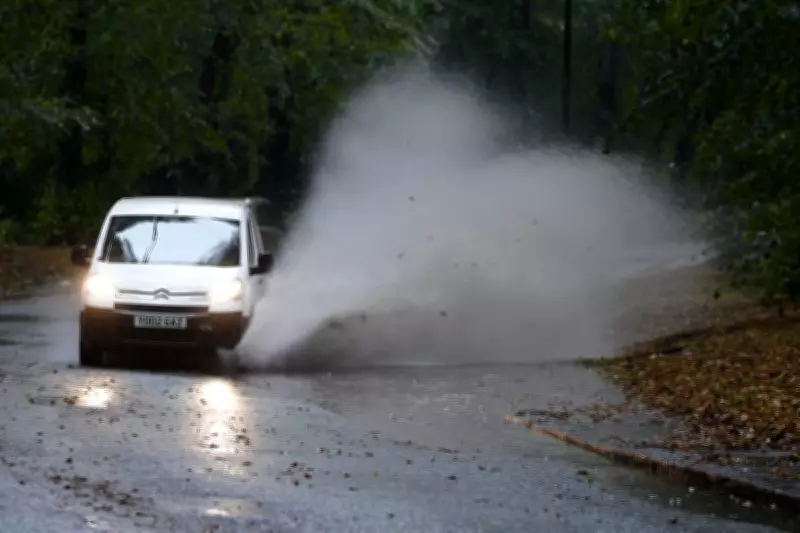
Persistent Flood Threats Nationwide
Simultaneously, the Environment Agency has called for public vigilance due to ongoing flood risks. As of Sunday morning, there were 74 flood warnings and 162 flood alerts in place across England.
In an afternoon update, the agency stated: "Ongoing impacts from groundwater are probable for parts of the south of England through the next five days." It added that river flooding is likely in Somerset and Wiltshire, while possible in parts of the Midlands from Sunday until Tuesday. The agency warned that properties could flood and travel may be significantly disrupted.
Detailed Weather Forecast for the Coming Days
According to the Met Office, rain is expected to clear in some eastern areas by evening, but heavy showers will persist through much of the night. Some snow is possible over the highest hills in the north.
- Monday: A day of sunny spells and showers, with some heavy downpours bringing risks of hail and thunder. Snow showers are anticipated in the far north.
- Tuesday: Drier conditions with sunny spells are forecast.
- Wednesday and Thursday: An increasing risk of rain and perhaps some hill snow in the south, while other regions remain mostly dry. Frosty nights are expected.
The combination of snow warnings and flood alerts underscores a volatile weather pattern affecting the UK, with authorities emphasising preparedness and caution for residents across multiple regions.


