
UK Braces for 'Beast from the East' Snowstorm with -4C Temperatures
Weather forecasting maps indicate that a significant snowstorm, dubbed the 'Beast from the East', is poised to sweep across the United Kingdom in the coming days. This meteorological event is expected to bring frigid conditions and substantial snowfall to numerous major cities, including London and Birmingham, with temperatures potentially plummeting to as low as -4 degrees Celsius.
Forecast Details and Snow Predictions
According to the GFS weather model, cold air masses will form over Europe on March 12 and subsequently drift from east to west, impacting the UK. The initial snowfall is projected to commence in southern England and Wales around 9 pm on that date, with London anticipated to experience some accumulation. The snow is then forecast to move northward, reaching areas such as the Midlands and northern England by 6 am on March 13.
By midday on March 13, the GFS model suggests that snow will have extended to Northern Ireland and Scotland, with the heaviest snowfall expected over hills in northern England. Snow coverage maps reveal that nearly all of England and Wales could have snow settled on the ground by this time, creating widespread wintry conditions.

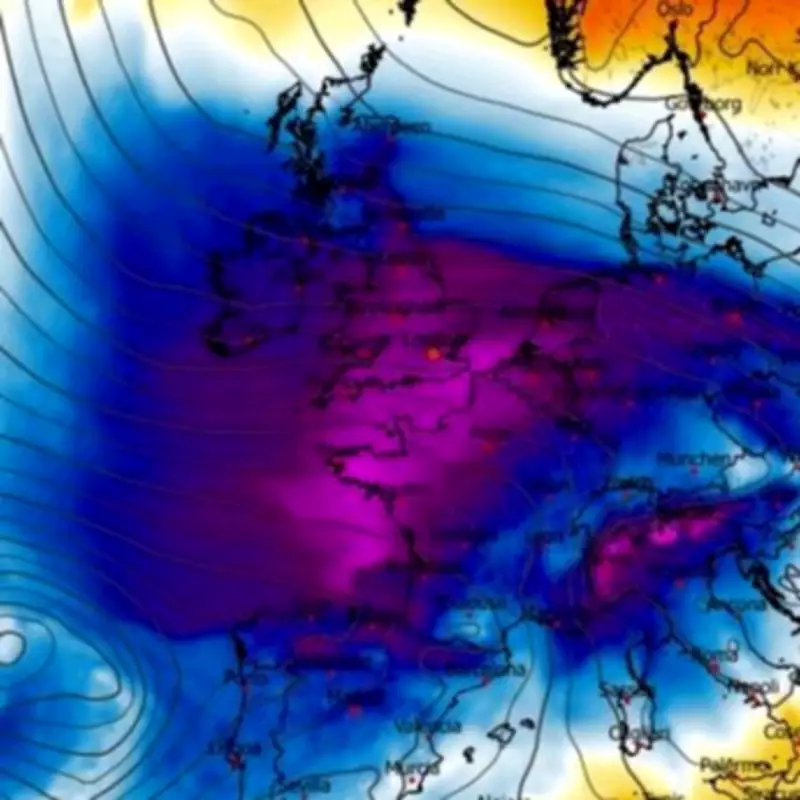
Temperature Drops and Regional Impacts
Temperature maps accompanying the forecast indicate that southern England might see the mercury drop to -4C, while other regions will also experience significant chills. Wales, Northern Ireland, Scotland, and northern parts of England could face temperatures as low as -2C, with the Midlands potentially reaching -1C. This cold snap is part of a broader pattern of chilly weather anticipated for March, although exact severity remains uncertain.
Major cities in the firing line include Birmingham and Manchester, both of which are likely to see flurries as the snowstorm progresses. The widespread nature of this event means that urban areas and rural locales alike will be affected, potentially disrupting travel and daily activities.
Broader Weather Context and Forecasts
The BBC Weather forecast for March 9 to 22 notes that the UK is likely to be situated between European high pressure and Atlantic low pressure systems during this period. This setup may bring occasional rain and brisk winds, with overall conditions expected to be milder than average or near seasonal. However, there is a slight possibility of chiller outbreaks in the second half of March, though this remains speculative at present.
Similarly, the Met Office forecast for March 3 to 12 suggests that high pressure will dominate, especially in the south or southeast, leading to dry weather with variable cloud and sunshine. Frontal systems may still affect the north and west, bringing rain, strong winds, and some snow to high ground in the north. Temperatures are expected to be near or above normal, with patchy overnight frost possible.
Despite these broader forecasts, the immediate threat from the 'Beast from the East' underscores the potential for severe winter weather as early as mid-March. Residents across the UK are advised to stay updated on local weather warnings and prepare for possible snow accumulations and icy conditions.


