
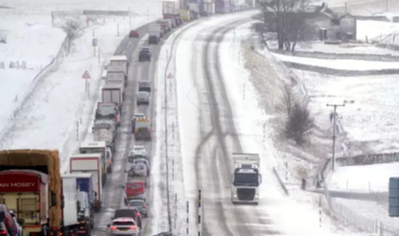
Storm Pedro Map: Snow and Ice Warnings Issued Across UK This Week
Snowy and icy conditions are anticipated in various regions of England this week, with the Met Office issuing yellow weather warnings for multiple areas. The warnings come as Storm Pedro is forecast to bring a mix of rain, ice, and snow across the country, potentially causing significant disruption.
Weather Warnings and Affected Areas
Yellow weather warnings for ice and snow have been activated for much of Wales, along with central and southern England. These warnings are effective from Wednesday afternoon through to early Thursday morning. Additionally, rain warnings have been issued for the south coast, spanning from 6am on Wednesday until 8am on Thursday, as coastal areas brace for heavy downpours.
Met Office experts have cautioned that periods of intense rain and snowfall could result in localized flooding and travel delays. Forecasters predict widespread rainfall of 10-20mm, with the south coast potentially receiving up to 30mm. Dartmoor in Devon may experience as much as 50mm of rain.

Snow Accumulation and Icy Conditions
There is a potential for rain and snow to impact parts of Wales, central England, and the southern Pennines from Wednesday evening into Thursday. Snow accumulation is expected primarily on higher ground, with 2-5 cm forecast widely above 150-200 metres. In mid and southeast Wales, Herefordshire, Shropshire, and the southern Pennines, elevations above 250-300 metres could see 10-15 cm of snow.
Lower elevations may witness minor snow accumulations of less than 2 cm from late Wednesday evening into early Thursday. Icy conditions are also predicted in parts of Wales and southwest England, increasing the risk of slips and falls on untreated surfaces.
Health and Travel Implications
The UK Health Security Agency has issued cold weather warnings for several regions in England, including the East Midlands, West Midlands, North East, North West, South West, East of England, and Yorkshire and the Humber. These alerts are in effect from 6pm on Tuesday until 6pm on Friday.
The agency warns that the cold weather could lead to increased demand on healthcare services and pose a greater risk to vulnerable individuals. This follows a year marked by repeated flooding incidents across Britain, including disruptions from last month's Storm Chandra.
Forecast Details and Weekend Outlook
Deputy chief forecaster Steven Keates noted that initial snow may affect the highest parts of southern England, such as Dartmoor, but the main snow risk lies in the Midlands and mid- to southeast Wales. A sharp frost is likely in parts of Scotland on Wednesday morning, with further frost and ice possible overnight into Thursday.
Senior meteorologist Craig Snell described Wednesday as a "very wet and windy morning" for many, though northern England may experience drier conditions. By late Thursday, winds are expected to ease, leading to a gradual improvement. The weekend promises milder temperatures, potentially reaching the low-to-mid teens, with further spells of wind and rain but an overall uplift in conditions.


