
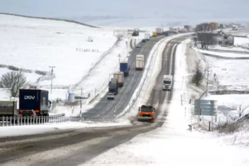
A yellow weather warning for snow and ice remains in force across the United Kingdom, with flooding expected in more than 70 areas as the nation braces for continued severe conditions. The alert, issued by the Met Office, covers most of Scotland and extensive regions of England, remaining active until 10am on Sunday.
Flood Warnings and Alerts in Place
On Saturday night, the Environment Agency reported 74 flood warnings and 163 flood alerts across England, urging the public to stay vigilant amid the ongoing risk. Jonathan Day, flood duty manager at the Environment Agency, stated that while over 24,000 homes and businesses have been protected from flooding, approximately 330 properties have already been affected by floodwaters.
Snow and Ice Disruption Forecast
The Met Office has warned that snow in the affected areas could be "heavy at times," potentially causing significant travel disruptions. Accumulations of 1-3cm are possible at low levels, with 3-7cm expected above 150 metres elevation, and up to 10-15cm above 400 metres. The warning highlights that outbreaks of rain spreading eastwards on Saturday night will initially fall as snow, even at low levels, before becoming confined to higher ground as milder air arrives from the west.

Areas sheltered to the north of high ground may see minimal snowfall, but ice poses an additional hazard, particularly in north-east England and parts of Scotland where precipitation could fall on frozen ground, creating very slippery conditions. The snow is forecast to turn increasingly to rain by Sunday morning, possibly as a short spell of freezing rain in some places, before clearing to the east with a steady thaw of lying snow.
Weather Outlook for Sunday and Beyond
Met Office meteorologist Greg Dewhurst indicated that Sunday will begin with a blustery start for many, accompanied by outbreaks of showery rain and some hill snow. Milder air will move into the south-west, with temperatures in Cornwall and Devon potentially reaching 12°C, while eastern regions may experience cooler conditions around 4°C to 5°C.
Looking ahead to next week, the weather is expected to remain unsettled and blustery, with further showers across the entire country. These conditions are predicted to ease into Tuesday, but another weather system will arrive on Wednesday, bringing more unsettled weather. Thursday is anticipated to be drier, offering a brief respite from the ongoing storms.
The series of warnings that expired throughout Saturday have been replaced by this ongoing alert, emphasising the need for caution as the UK navigates this period of extreme weather. Residents are advised to monitor updates from the Met Office and Environment Agency closely.


