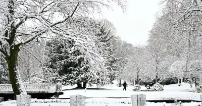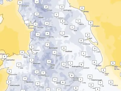
The Met Office has issued a yellow warning for snow affecting parts of the North East, including County Durham and Northumberland, as temperatures plunge and the polar vortex is being monitored for potential impacts on UK weather.
Brief flurries were seen in some areas on Monday morning, with more snow expected in the early hours of Tuesday. This comes as the Met Office earlier this month reported that the stratospheric polar vortex high above the North Pole was being disturbed, with signs of a developing sudden stratospheric warming (SSW).
What is the polar vortex?
Met Office experts explain that the stratospheric polar vortex (SPV) is a large-scale circulation of very strong winds found high above the Arctic during winter. It sits in the stratosphere, around 10 to 50km above the surface, and circles a pool of very cold air over the North Pole. Changes in its strength and shape can influence the atmosphere below.
During winter, the polar vortex can strengthen, weaken, stretch, shift away from the pole, or split apart. When it is strong and stable, it tends to support a strong, relatively straight jet stream across the North Atlantic, which often brings milder, wetter and windier conditions to the UK. When it weakens, the jet stream can become more meandering, increasing the chance of colder air moving south out of the Arctic and raising the likelihood of colder, drier spells for the UK.
Disturbance and monitoring
The Met Office said: "The stratospheric polar vortex is already unusually stretched, with the disturbance associated with so-called 'wave two' activity, when two large atmospheric waves push into it from opposite directions. This wave two activity is considerably stronger than average for the time of year. Forecasts suggest the vortex will subsequently become increasingly displaced from the North Pole."
Monitoring the vortex is an important part of understanding winter weather risks. A strong vortex often supports mild, wet and windy weather from the Atlantic, while a weakened or disrupted vortex can increase the chance of colder, more blocked patterns.
El Niño's role
El Niño is characterised by unusually warm sea-surface temperatures in the tropical Pacific. Met Office experts say the current event is exceptional and "this warmth can influence weather patterns far beyond the tropical Pacific".
Met Office presenter and meteorologist Aidan McGivern said: "El Niño is basically enhancing the waves that go on in the troposphere, the wriggly jet stream. Those waves can then propagate upwards into the stratosphere, knocking, bumping and disturbing that circle of winds around the polar stratosphere, causing it to be displaced, pushed off the pole, deformed or even split."
He added: "We know that El Niños increase the chances, through this chain of events, of sudden stratospheric warmings happening, and we know sudden stratospheric warmings increase the chance of colder weather for the UK. So we've got this chain of events that we can start to flag well in advance."
Possible UK impacts
The Met Office says: "A major sudden stratospheric warming does not automatically mean snow or severe cold for the UK. When an SSW occurs, its effects can sometimes propagate downwards into the troposphere over the following two to six weeks. This can weaken the Atlantic jet stream and increase the likelihood of blocking areas of high pressure developing."
It adds: "For now, therefore, this is not a forecast of an impending UK cold spell. Instead, meteorologists will be closely monitoring the polar vortex and whether changes in the stratosphere eventually work their way down into the part of the atmosphere where our day-to-day weather takes place."