
Forecasters from the Met Office have issued urgent warnings of a significant and abrupt change in the UK's weather pattern over the coming week. This shift will replace recent sunshine and warmth with much colder, wetter conditions, bringing the potential for hail, thunder, and even some snow.
A Sudden End to Spring Warmth
The nation enjoyed a notably balmy spell this past week, culminating in the warmest day of the year so far. On Wednesday, the temperature in Gogerddan, Wales, soared to nearly 23 degrees Celsius. However, this spring-like interlude is set to end abruptly.
Cold Front Brings Widespread Disruption
Meteorologist Greg Dewhurst explained that a cold front is moving southwards across the country, heralding this dramatic transformation. From Sunday onwards, temperatures are predicted to plummet, falling "widely below average" for late March, when typical averages hover around 11 degrees Celsius.

Honor Criswick, another Met Office forecaster, provided detailed insights into the incoming conditions. "The weather is turning colder from Wednesday, but there will be both sunshine and showers," she stated. "Some showers will be heavy with some hail and thunder, and may bring some snow to modest hills, with small accumulations likely."
Hazardous Conditions Expected
The forecast indicates several specific hazards:
- Heavy showers accompanied by hail and thunder.
- Potential for ice formation on Tuesday and Wednesday nights.
- Brisk northerly winds, making temperatures feel even colder, potentially dipping into low single figures for many areas despite actual readings of 6 to 10 degrees Celsius.
- Strong wind gusts, possibly reaching 30 to 40 miles per hour in north-west Scotland on Monday.
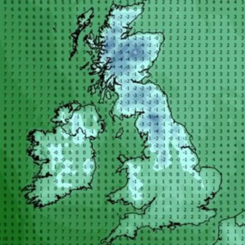
This represents a stark contrast to the recent warmth, with the Met Office emphasising it will be a "big change" from the record temperatures experienced just days prior. Weather maps suggest the mercury could slide below zero in parts of the country next week, underscoring the severity of the incoming cold snap.


