
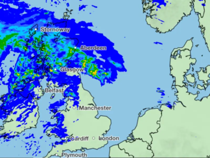
Rain is expected to hit 12 areas in Scotland on Tuesday, July 28, according to the Met Office. More than 50 council areas across the UK will see precipitation, with rainclouds moving north-eastwards from Northern Ireland, Wales, and England into Scotland.
Heaviest Rain in Central Scotland
The heaviest rain is forecast around 3am, with an orange rain cell delivering 8-16mm near the South Lanarkshire village of Douglas, the Met Office map shows. After mid-morning, scattered showers will persist in Northern Ireland, north Wales, north west England, and Scotland. The Midlands, East Anglia, and southern England are expected to stay dry.
Met Office Forecast
The Met Office forecast for Tuesday said: “Heavy rain in the north will ease and move away northeastwards on Tuesday, replaced by sunshine and locally heavy showers. England and Wales mostly dry with some hot sunshine developing.”
Temperatures will remain warm: Glasgow 20C, Edinburgh 21C, Aberdeen 22C, and Newry 23C.
Areas Affected by Rain
The 53 council areas set to see rain include:
- Scotland (12): Aberdeen City, Aberdeenshire, Argyll and Bute, City of Edinburgh, Dumfries and Galloway, Fife, Glasgow City, Highland, Na h-Eileanan Siar, North Lanarkshire, Scottish Borders, South Lanarkshire
- Northern Ireland (4): Belfast City, Causeway Coast and Glens, Derry City and Strabane, Fermanagh and Omagh
- Wales (9): Cardiff, Carmarthenshire, Ceredigion, Conwy, Gwynedd, Isle of Anglesey, Pembrokeshire, Swansea, Vale of Glamorgan
- England (28): Greater Manchester (10 areas), Merseyside (5), Cumberland, Lancashire, Westmorland and Furness, County Durham, Gateshead, Newcastle upon Tyne, Northumberland, North Tyneside, South Tyneside, Sunderland, Cornwall, Devon, Plymouth




