Met Office weather maps show rain downpours in 51 counties on Friday
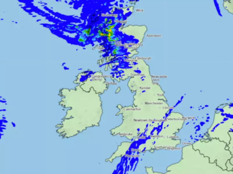
Several counties across the UK are set to see rain tomorrow as the heatwave finally begins to subside, according to Met Office weather maps. Showers are expected in England and Scotland at midday on Friday, with a band of rain stretching across the country.
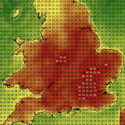
Weather forecasting maps from the Met Office indicate that dozens of counties across the UK will experience downpours tomorrow. This follows a period of high temperatures that have remained above the official heatwave threshold in some areas, particularly in the south. The mercury is expected to reach 33°C today, 29°C tomorrow, and 29°C again on Saturday in southern areas. In the north, maximum highs of 29°C, 24°C, and 24°C are forecast over the three days, the Met Office says.
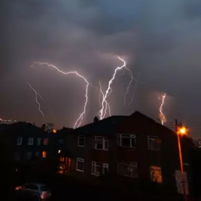
However, the Met Office has also issued several warnings for thunderstorms in recent days. Now, maps from the national weather service show more rain is expected tomorrow. The maps reveal heavy rain across almost all of Scotland at midday, while a band of rain stretches across England from the south-west to Lincolnshire. This band is expected to move south-eastwards throughout the day, reaching London by 5pm.

In total, the Met Office maps suggest that as many as 51 counties across England, Scotland, and Northern Ireland should see some rain. Wales is expected to remain largely dry.
UK counties facing rain on Friday
England: Devon, Somerset, Dorset, Gloucestershire, Wiltshire, Warwickshire, Northamptonshire, Lincolnshire, Norfolk, Suffolk, Cambridgeshire, Oxfordshire, Berkshire, Buckinghamshire, Bedfordshire, Essex, Hertfordshire, Hampshire, Surrey, Kent, Sussex, Leicestershire, Yorkshire, Cumberland, Northumberland.
Scotland: Caithness, Sutherland, Ross-shire and Cromartyshire, Inverness-shire, Banffshire, Aberdeenshire, Argyllshire, Perthshire, Angus, Kincardineshire, Clackmannanshire, Stirlingshire, Dunbarton, Renfrewshire, Lanarkshire, Buteshire, Ayrshire, Wigtownshire, Kirkcudbrightshire, Dumfrieshire, Roxburghshire, Midlothian, Peebleshire, Selkirkshire.
Northern Ireland: Londonderry, Tyrone.
Met Office latest weather forecast
In its latest weather forecast, the Met Office said temperatures will continue to ease and turn fresher as the hot spell breaks on Friday. 'Most will see a noticeable drop from the hottest conditions of recent days, but still above average for many, with the peaks of 28°C increasingly confined to the far southeast,' forecasters said.
'Spells of rain will be seen across parts of Scotland and Northern Ireland at first, before moving further north. Though some cloud and patchy rain linger in central and southern areas, much of England and Wales will turn brighter and drier through Friday.'
Met Office Chief Forecaster Chris Bulmer said: 'We're now starting to see this spell of very hot weather break down. While parts of the southeast could still reach highs of 32°C on Thursday, many areas will begin to feel fresher conditions moving in through Friday and into the weekend as a weak cold front moves southeast and becomes more established across most of the UK by Saturday.
'As the heat starts to ease, the weather will also turn more changeable, with some showers and thunderstorms possible. By the weekend, temperatures should be much closer to average for the time of year with accompanying rainfall for many through the weekend and into the start of next week.'