A record-breaking El Niño unfolding in the Pacific Ocean is clearly raising the chance of extreme weather in London this winter, according to a top scientist.
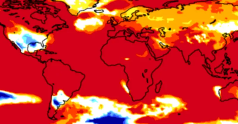
Sea surface temperatures in the Pacific have been recorded at 4C above normal, the Japan Meteorological Agency revealed on Friday, the highest reading since records began.
The so-called “Godzilla” El Niño is worrying scientists and governments around the globe amid fears it will spark natural disasters and extreme weather that will claim hundreds of thousands of lives.
Impact on Britain
Britain, along with much of Europe, should escape the worst of the impact as El Niños have a much stronger bearing on weather patterns in regions such as India, East Asia, South America and parts of Africa.
However, the UK Government has warned that Britons face higher prices for foods like rice and coffee if harvests are badly impacted, while energy bills could also spike. The El Niño is expected to peak in December and last through to February 2027.
In an interview with The Standard, Tim Stockdale, principal scientist at the European Centre for Medium-Range Weather Forecasts (ECMWF), stressed that Britain’s “more variable” weather made it harder to predict how the El Niño will impact the UK over the winter.
Wetter and windier start
But he said the science was clear: there is a “greater likelihood” of more extreme weather in the coming months.
“There’s an expectation of the first part of the winter being milder, wetter and windier,” said Mr Stockdale. That could even be good news for southern England given this year’s drought, he added, with water levels needing to “recharge”, while also providing plenty of wind power.
“Later winter is a more complex story, although big El Niño events can be associated with colder weather. It is variable (but) the probabilities are there. Where the balance of things will be in later winter, I don’t feel confident about it.”
The last “super” El Niño to hit London during the winter of 2015/16 and subsequent spring brought damaging storms and freezing weather to the capital. A 90-year-old man died after he was blown in front of a bus in Finchley, north London, as the UK was blasted by Storm Desmond. Over Easter 2016, the capital was rocked by Storm Katie, with high winds bending a construction crane in Greenwich and dozens of roofs damaged across the capital.
Unprecedented stress
Mr Stockdale warned the world is facing an unprecedented danger with an El Niño “as big as we have ever seen” combining with global warming.
He said: “When we first were predicting this back in March and April, it really was a prediction - it wasn’t actually happening. Our models told us this big El Niño was coming. When we got to June, the models were pointing to a record El Niño. Now, as we speak, the El Niño is here.
“The temperatures in the middle of the Pacific are warmer than they have ever been before. They are breaking the records by quite a big margin. It’s as big an El Niño as we’ve ever had. But then it’s happening on top of global warming.”
He said scientists and meteorologists are “very nervous” about how this unprecedented cocktail will impact weather patterns. “Aid agencies are very worried. It’s hard to predict where the disaster will strike but if you put the system under this amount of stress then you are likely to have bigger problems. We’re seeing weather system stress like we’ve never seen before. Looking at the Tropics, the patterns of sea surface temperatures - I’ve never seen anything like it. We know the tropical oceans drive the world’s weather and we’ve never seen them in this state before.”