
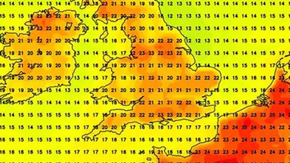
Britain is bracing for a mini-heatwave as a plume of warm air from France is set to send temperatures soaring above 20C by the end of May. Weather maps from Netweather and WXCharts indicate that by Friday May 31, the UK could see temperatures in the low to mid-20s, particularly along the south coast and southeast, while parts of France near Biarritz could reach 30C.
The warm spell is expected to bring pleasant conditions to northern England, Wales, Northern Ireland, and even Scotland's far north. However, the Met Office warns that heavy rain and thunderstorms are likely in the lead-up to the heatwave, with a warning already issued for Northern Ireland.
Deputy Chief Meteorologist Dan Rudman said: “Low pressure is going to influence our weather from the middle of this week, bringing some heavy rain to parts of the UK. Eastern areas are most likely to see the highest rainfall accumulations.” He added that severe weather warnings could be issued as the forecast becomes clearer.

As the month draws to a close, conditions are expected to settle, with temperatures trending “a little above average” for the period leading up to May 31, coinciding with half-term for many schools. A Met Office spokesperson noted that while some southern and eastern areas may see showers, the best sunshine is likely in southwestern parts.
The heatwave follows a cooler, wetter spell, but forecasters predict a return to warmer weather just in time for the end of the half-term holidays. The Met Office advises keeping an eye on the forecast as details become clearer.


