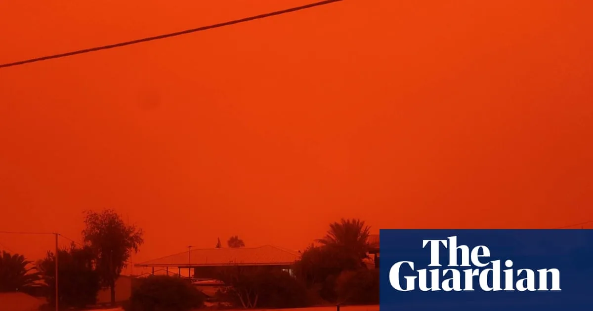
Tropical Cyclone Narelle has unleashed a trail of destruction across Western Australia's northwest, leaving residents in a series of isolated coastal towns covered in a thick layer of red dust while being battered by fierce winds. The cyclone, which made landfall near Coral Bay, has caused significant damage, particularly in the holiday town of Exmouth, where winds topped 250km/h.
Red Dust Blankets Carnarvon as Cyclone Narelle Strikes
As Cyclone Narelle crossed the coast, it brought with it an unusual and dramatic phenomenon: a thick red dust storm that engulfed Carnarvon for approximately two hours. Shire president Eddie Smith reported that wind gusts during this event reached speeds of over 100km/h, creating hazardous conditions and reducing visibility across the region.
Exmouth Bears the Brunt of Narelle's Fury
The full force of Cyclone Narelle was felt in Exmouth, located 1,250km north of Perth, when the storm was still a category four system. The cyclone generated winds in excess of 250km/h, leading to widespread devastation. Roofs were torn off buildings, power supplies were cut, homes were flooded, and approximately 50 people had to evacuate from the town's evacuation centre after it sustained wind damage.
Department of Fire and Emergency Services Commissioner Darren Klemm expressed concern about the extent of the damage, stating, 'We're expecting some pretty significant damage.' He emphasized that emergency services would work closely with local governments and communities to assess needs and provide support in the aftermath of the cyclone.
Cyclone Narelle's Complex Path and Weakening
Cyclone Narelle was downgraded to a category two system overnight after initially making landfall as a more powerful storm. It tracked from the Kimberley region down the Pilbara coastline, impacting multiple towns along its path. Commissioner Klemm described Narelle as an 'incredibly complex cyclone' due to this trajectory, which ensured widespread effects across the coastal communities.
After making landfall just south of Coral Bay, the storm weakened to a category three system. It then passed to the east of Carnarvon on Friday afternoon before further weakening into a category two system northeast of Kalbarri and Geraldton.
Ongoing Threats and Future Trajectory
As Cyclone Narelle continues its southeast trajectory, it is expected to move into the northern Wheatbelt on Saturday. Authorities warn that damaging winds and heavy rainfall are possible in southeast Western Australia as the system passes through the Wheatbelt region. Eventually, the cyclone is predicted to move off the south coast into the Southern Ocean, but not before posing further risks to inland areas.
The combination of high winds, flooding, and the unusual red dust storm has created a multifaceted emergency situation, with recovery efforts likely to be prolonged as communities assess the full impact of Cyclone Narelle's destructive passage.


