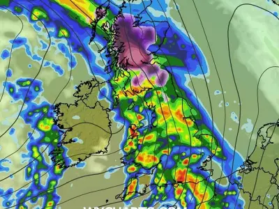
Britain is set to be hit by a 760-mile band of rain and snow within days, the latest weather maps have suggested. According to the weather charts generated by WXCharts, areas ranging from Wick in Scotland to Cornwall in England will experience unsettled conditions on November 24.
The weather maps show that snow will be peppered in areas around Inverness and Fort William in Scotland, while the remaining areas of the country will be drenched in the rain.
Met Office yellow warning for snow
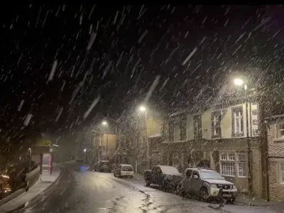
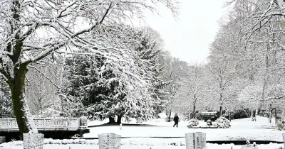
The dramatic weather map comes as the Met Office issued a yellow warning of snow for 18 areas across the UK. The weather warning, which was updated on Monday morning, has been issued for parts of southern Scotland and northern and central England from overnight Monday and into Tuesday.
The UK Health Security Agency has also issued a yellow cold-health alert for the North West, North East and Yorkshire and the Humber, which is in place until Thursday morning.
Long-range forecast for late November
The Met Office's long-range forecast between November 21 and 30 reads: "Bands of rain will move in from the Atlantic at times, making erratic and uncertain eastward progress across the UK.
"These systems may also bring occasional strong winds. Either side of bands of rain a mixture of clear/sunny spells and showers.
"Often rather cold in northern areas which could allow precipitation to fall as snow at times, mainly over hills.
"Generally milder in the south though still potential for some nights in clearer spells.
"Through late November, there is an increasing chance that high pressure will start to have more influence bringing more settled conditions, particularly across the north."
Polar vortex weakening and potential impacts
Temperature levels are likely to oscillate between 1 and 2C, the maps show. In recent weeks the polar vortex has weakened and shifted position. Observations have now shown a switch to easterly winds, which experts say defines a 'major sudden stratospheric warming' or SSW.
The vortex is a powerful band of winds circulating around 30km above the Earth, normally keeping frigid Arctic air contained in the polar region. When it weakens, this cold air can escape southwards, potentially triggering severe winter weather. A similar disruption contributed to the Beast from the East in 2018.
Meteorologists and climate scientists are now investigating whether this year's record-breaking El Niño conditions in the Pacific Ocean could be linked to the unprecedented early weakening of the polar vortex.