
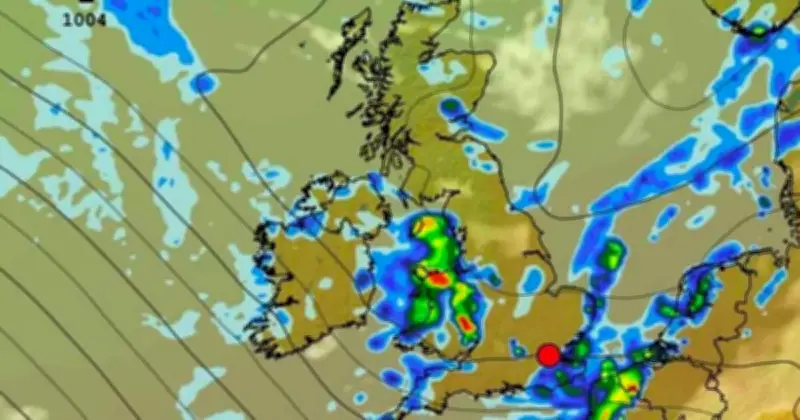
Weather maps show a 390-mile-long band of rain is set to drench a swathe of the UK from Blackpool to Penzance in a few days' time. Some spots could see up to 5mm fall per hour, according to maps generated by WX Charts on Tuesday (July 21).
While the large band of rain appears over coastal areas of Cumbria, Lancashire, North Somerset, Devon and Cornwall at midnight on Sunday (July 26), North Wales and the England-Wales border look set to see some of the heaviest rainfall, according to one WX Charts map. Another map shows rain over parts of Northern Scotland at 3am on Saturday (July 25).
Met Office forecast
Met Office meteorologist Claire Nasir said on Wednesday (July 22) that a more active weather front pushes into the UK from late on Friday into Saturday, with showers heading southwards. She added: "More rain though across the north, which is good news for parks, gardens and farmland."
Before then, the far north west of Scotland will see a few patches of rain on Wednesday afternoon, with fleeting showers across the north east, according to the meteorologist. Ms Nasir said much of the rest of the UK will be very warm, with 25-28C in the south and some high UV levels. It will be a fine end to the day for most, though rain will affect the north and northwest of Scotland.
Thursday morning will be bright for much of England and Wales, though the east coast of the UK could see more cloud. Most will see sunny spells with the chance of an isolated shower across parts of central and eastern England, according to the Met Office.
The weather on Friday will be similar, with the mercury rising to 27C in London and Cardiff, 25C in Manchester, 22C in Belfast and 21C in Edinburgh. It will be breezy in northern Britain too. Ms Nasir said: "Into the weekend though, we will see a change as more cloud arrives and then some outbreaks of rain."
Five-day forecast
The Met Office UK five day weather forecast for Wednesday, July 22 to Sunday, July 26 has the headline: "Mostly dry, with sunny spells. Warm for most." Most areas will be dry with sunny spells today, especially across central and southern parts of the UK where it will be very warm. It will be cloudier and cooler across northern Scotland and parts of Northern Ireland, with some light rain or drizzle at times.
Tonight will be cloudy across northern Scotland and parts of Northern Ireland with some light rain or drizzle possible at times. Elsewhere will be dry with clear spells. A few fog patches are possible towards dawn.
On Thursday, most areas remain dry, with lots of sunny spells. The far north will be cloudier with a few showers possible. It will be warm inland, but cooler along the coast.
Friday to Sunday will be dry and very warm at first, especially in the south. Rain will then spread southeastwards over the weekend, with sunny spells and showers later. Temperatures will trend closer to normal by Sunday.




