The Met Office has issued a severe weather warning for much of the UK today, with forecasts predicting that nearly an entire month's rainfall could deluge the country within a single day.
Widespread Disruption Expected
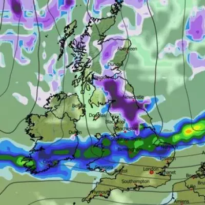
Forecasters are warning the public to prepare for significant disruption throughout Saturday. Travel chaos, flooding, and power cuts are considered likely, with south Wales and the Midlands expected to bear the brunt of the severe conditions. The heaviest downpours are anticipated to hit the Midlands during the morning before slowly tracking southeast across the country.
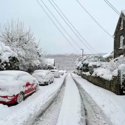
While some higher ground in areas like Cumbria, Lancashire, and the Isle of Man could see wintry showers, the primary threat for southern regions remains intense rainfall. In a concerning development, some locations could see up to 80mm of rain by the end of the day. To put this in perspective, the city of Birmingham typically receives less than 80mm of rainfall throughout the entire month of November.
Official Warnings and Flood Alerts
A yellow weather warning for rain is in force across several regions. The Met Office alert states that heavy rain will develop over southwest England on Friday night, spreading northeastwards during Saturday before clearing. There is potential for 20-30mm of rain to fall widely, with 50mm possible in some spots. Over high ground, there is a small chance of a deluge reaching 60-80mm.
The Environment Agency has bolstered these warnings by issuing 31 flood alerts across the nation. Particular concerns are focused on the River Erewash, which flows through Derbyshire and Nottinghamshire, where water levels are rising. Authorities are also monitoring rivers in the Forest of Dean in Gloucestershire.
Potential Impacts on Daily Life
The Met Office has outlined a series of potential impacts that the public should be aware of. These include:
- Spray and flooding on roads leading to longer journey times.
- Probable disruptions to bus and train services, with a chance of cancellations.
- A chance that homes and businesses could be flooded, causing property damage.
- A small chance that some communities become cut off by flooded roads.
- A slight chance of power cuts and the loss of other essential services.
The situation is especially precarious as it follows earlier downpours this week. More than 40mm of rain was recorded in the Scottish Highlands on Thursday, and parts of Northumberland saw around 25mm. Although Sunday is expected to be drier, another barrage of rain is forecast to sweep in from the west on Monday, again targeting southern regions with the heaviest falls.


