Advanced weather forecasting models are indicating a significant snow event for the United Kingdom, with predictions of three consecutive days of blizzards potentially bringing up to five inches of accumulation. Major cities including London and Manchester are expected to be impacted, according to the latest meteorological data.
Three-Day Snow Timeline
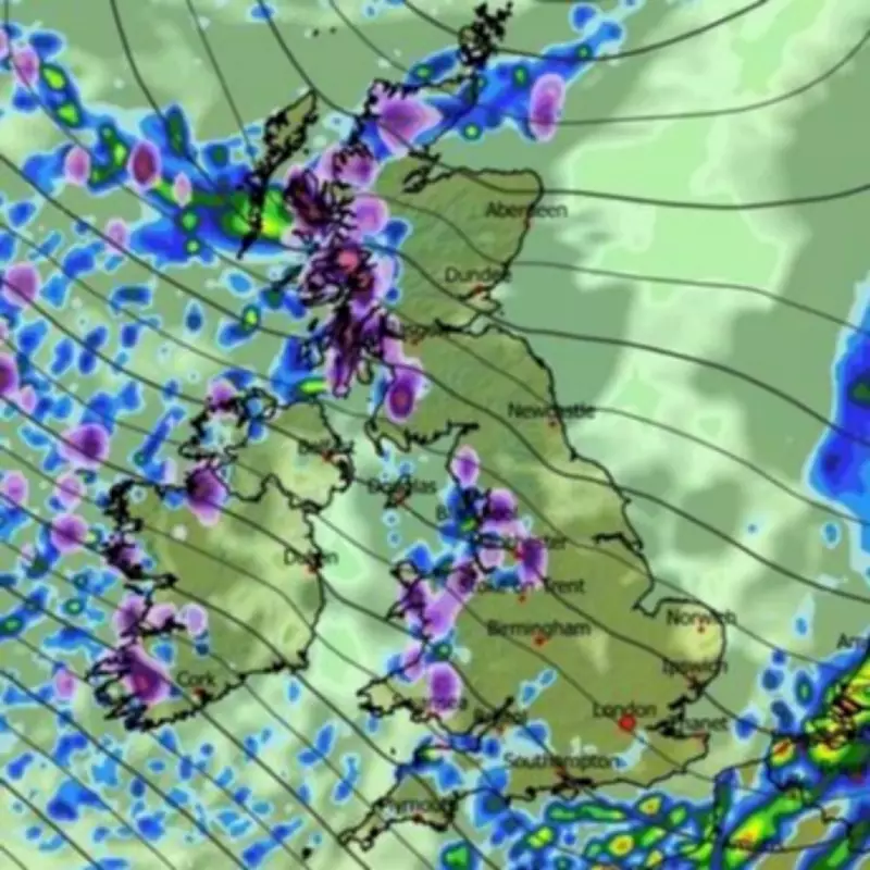
The European Centre for Medium-Range Weather Forecasts (ECMWF) model shows snow beginning in western parts of Scotland, England, and Wales during the early hours of Wednesday. The initial phase will see the heaviest snowfall concentrated in Scotland, where rates could reach approximately four inches per hour during peak intensity.
Wednesday's Snow Coverage
By midday on Wednesday, the snow is forecast to extend southward, reaching areas north of London and around Gloucestershire. Northern Ireland may also experience snowfall around this time. Accumulation maps indicate potential settled snow depths of 9cm in Scotland, 6cm in Wales, 3cm in southwest England, and 2cm in northern England and Northern Ireland.

Thursday and Friday Developments
Thursday is expected to bring more sporadic flurries, but Friday could see a more organized band of snow moving across the country. Weather maps for approximately 6am Friday show snowfall extending from Newcastle down to London, with accumulation potentially reaching as far south as Stoke-on-Trent.
Friday's snow coverage maps suggest Scotland could see up to 12cm (approximately five inches) of settled snow, representing the deepest accumulations of this weather event.
Official Weather Agency Forecasts
The Met Office has confirmed the potential for snow next week, stating that a cooler north-to-north-westerly flow will develop by Wednesday. This pattern is expected to bring frequent showers, some of which will be wintry over higher ground, with snow possibly reaching lower levels in northern regions later in the day.
The national weather agency noted: "Temperatures will be near or a little below average during this period, creating conditions conducive to snow accumulation in affected areas."
BBC Weather Agreement
BBC Weather forecasts align with these predictions, indicating that high pressure will shift away from the UK early next week, allowing frontal systems to bring wet and windy conditions. Between these systems, a brighter but chillier interlude with north-westerly winds will develop, bringing scattered showers that could turn wintry, particularly over higher ground in northern regions.
This coordinated forecast from multiple meteorological sources suggests residents across the UK should prepare for potentially disruptive winter weather conditions spanning multiple days next week.